Geology Reference
In-Depth Information
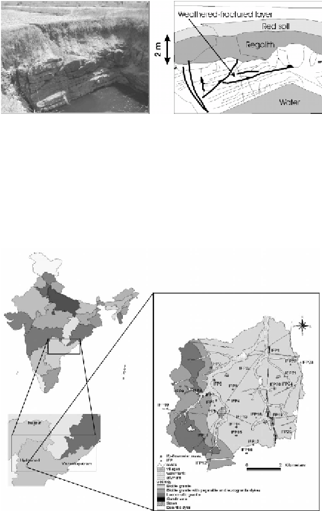
Figure 1.
Cross-section of the typical substratum in a dug-well.
are well developed in the main directions: N 0°-15°E, NE-SW, and NW-SE
that vary slightly from place to place. The groundwater flow system is local,
i.e. with its recharge area at a topographic high and its discharge area at a
topographic low adjacent to each other. Intermediate and regional groundwater
flow systems also exist since there is significant hydraulic conductivity at
depth. Aquifers occur in the permeable saprolite (weathered) layer, as well
as in the weathered-fractured zone of the bedrock and the quartz pegmatite
intrusive veins when they are jointed and fractured. Thus only the development
Figure 2.
Maheshwaram hard rock watershed in Ranga Reddy
Dist., Andhra Pradesh.