Geology Reference
In-Depth Information
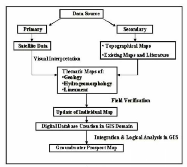
of India toposheets may be used for the preparation of base map. The
methodology of generation of thematic maps such as lithology, hydro-
geomorphology and lineaments of the study area requires visual interpretation
of satellite remote sensing data. Identification and delineation of various
units on the thematic maps are based on the colour, tone, texture, size,
pattern and association. All the thematic maps are verified during the field
checks. The thematic details thus finalized are transferred to the base map
prepared from the Survey of India toposheets. A typical method used in GIS
modelling is to compute numerical values for each spatial feature in a theme
and classify the numerical values on an interval basis known as Weighted
Index Overlay Analysis.
Flow Chart
HYDROGEOMORPHOLOGY
The hydrogeomorphology in the hard rock terrain is highly influenced by the
lithology and structures of the underlying formations. The area is characterized
by a dominant rocky terrain and a number of erosional and depositional
hydrogeomorphic features, which are manifested by hills, uplands and
undulating surfaces. The significant hydrogeomorphic units, commonly
identified on the basis of their image characteristics, include buried pediments