Environmental Engineering Reference
In-Depth Information
During construction the conditions found were essentially as predicted. Minor landsliding
occurred on the right bank dipslope when the surface soil and vegetation was stripped,
and again when a 4 m deep trench was cut directly down the slope (Regan 1980, Stapledon
1995). These occurrences under very low normal stress conditions confirmed the need to
use residual strength in the design.
Stability problems on the right bank proved more difficult than predicted, but early recog-
nition of this during construction enabled the design here to be modified with minor dis-
ruption of the works.
The evidence of thin seams and past slope movements at Sugarloaf was quite subtle and
may not have been found if it had not been consciously looked for and exposed in well-
prepared, very long, deep trenches.
2.10.3.5
Thomson Dam
The 166 m high Thomson Dam is an earth and rockfill structure located 120 km east of
Melbourne, Australia. It was constructed between 1977 and 1984.
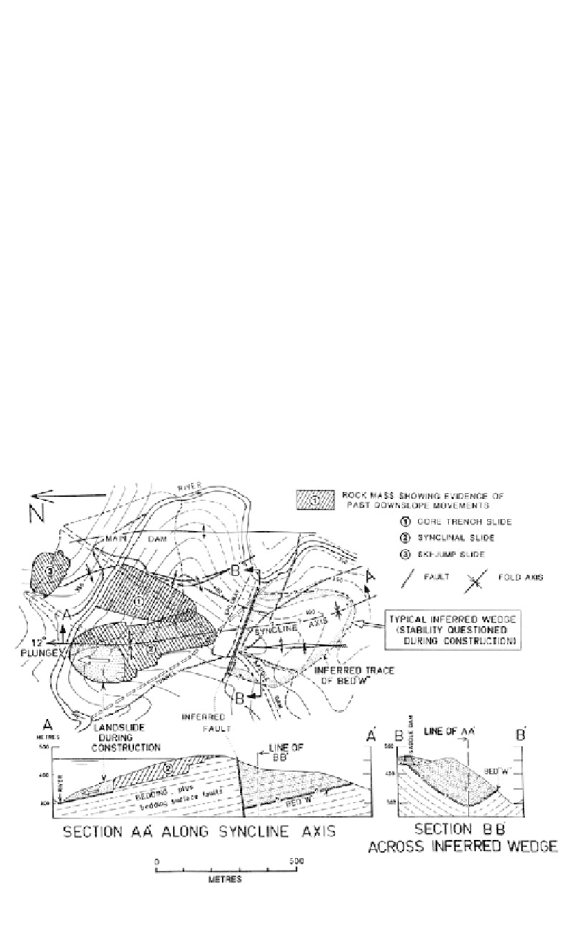
The site is underlain by a folded, interbedded sequence of siltstone and sandstone, sim-
ilar to that at Sugarloaf. However the folds are tighter and more complicated than at
Sugarloaf, there are many normal and thrust faults, and bedding-surface sheared and
crushed seams are spaced generally at less than 1 m intervals.
Figure 2.40 shows the major folds and faults at the site. Fold axes trend generally
north-south and plunge northwards. A major feature at the site is the Thomson Syncline
which plunges to the north at about 12°.
Although this fold pattern was recognised during the feasibility and pre-construction
design stages, its potential to contribute to instability of slopes and foundations was not
appreciated at that time.
Figure 2.40.
Thomson Dam site, geological plan and sections showing the main structural features.