Environmental Engineering Reference
In-Depth Information
To allow for this suspected landslide the dam axis was rotated to bring the upper right
shoulder downstream of it (
Figure 2.34
)
. It was planned to investigate the area further
during construction, and it was expected that much of the landslipped material near the
embankment would be removed during excavation of the spillway approach channel.
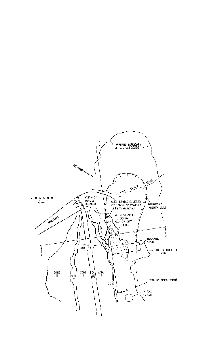
During stripping of the foundation and placement of fill, four landslides occurred from
the area below the suspected old slide. The slides cut through a construction access road,
and the fourth and largest slide (about 100,000 m
3
) cut through the spillway approach
channel and moved into the upstream rockfill and filter zones (Lilly, 1986).
At this stage it was appreciated that the stability of the dam embankment was also in
question, and a major investigation involving 17 diamond drillholes was carried out.
Excavation of the slide material in the foundation area showed that the basal failure
surface here was a seam less than 50 mm thick of micaceous clayey silt, probably a weath-
ered and sheared, basic dyke. The seam was slightly undulating and dipping almost
directly downstream (i.e. beneath the dam) at about 15°. The slide mass here was a wedge
bounded by this seam and a joint striking roughly at right angles to the river, dipping 80°
upstream (Figure 2.35). Movement had been directly towards the river at the wedge inter-
section plunge angle of about 5° (
Figure 2.36
, Section BB). Although water pressures
Figure 2.35.
Wungong Dam, right abutment, plan showing the extent of the fourth landslide and reme-
dial works. (based on Lilly, 1986).