Environmental Engineering Reference
In-Depth Information
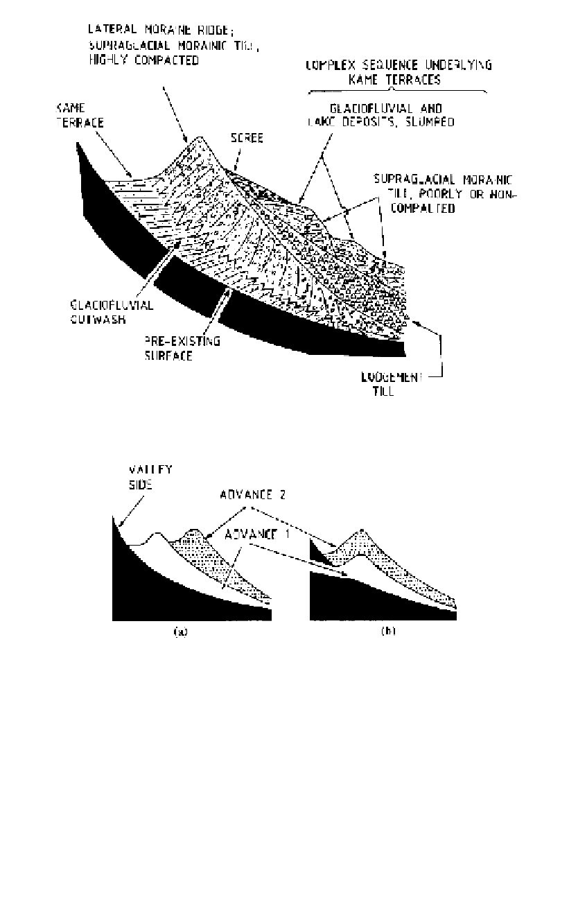
Figure 3.49.
Diagrammatic section through a lateral moraine ridge (Boulton and Eyles 1979).
Figure 3.50.
Lateral moraine ridges deposited by successive glacial advances. (Boulton and Eyles, 1979).
The lateral moraine and associated deposits are usually more complex than shown on
Figure 3.49 because of repeated glacial advances and retreats. Figure 3.50 shows the rela-
tionships between lateral moraine ridges deposited by successive glacial advances. In
Diagram (a) Advance 1 was more extensive than Advance 2, and in Diagram (b), Advance
1 was the less extensive.
Figure 3.51
is the complete glaciated valley land system, showing common features of
the ablation zone and the deposited materials and landforms. Numbered features on this
diagram which need further explanation are discussed below.
The lodgement till (1) at the base of the glacier is poorly sorted, usually containing
more than 50% of sand, silt and clay sizes, forming a matrix which supports gravel and
larger sized particles. When unweathered, the fines fraction usually comprises finely
ground quartz, carbonate and inactive clay minerals. The lodgement till is well compacted