Environmental Engineering Reference
In-Depth Information
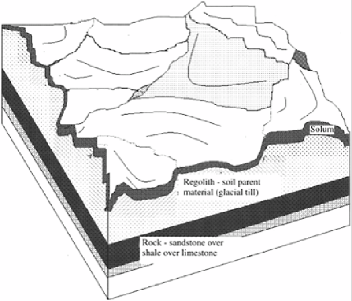
FIGURE 1.1
A landscape including surface and subsurface features.
Sampling can include any method of obtaining information, such as remote sensing,
about the condition or components in the field. When discussing field sampling it is
important to make sure that all terms are used in an unconfusing way.
1.1.
ASSESSING THE SAMPLING NEEDS
An eye-level examination from one position in a field may provide a biased assessment
of the sampling needed. It may also lead to unsafe and costly errors in developing the
sampling plan.
In addition to viewing the field, in starting a sampling project some premature work is
often done. Statistical tools may be applied to the assumed situation. Other times,
someone goes to the field without thinking and grabs a sample and has it analyzed. All
this activity may have the semblance of being intended to determine the level of a
component or components present in a field. Some useful information may be obtained.
To obtain accurate and useful information, however, a detailed, well thought out
sampling plan based on an understanding of the environment in general and the specific
characteristics of the field to be studied must first be developed.
Search WWH ::

Custom Search