Geoscience Reference
In-Depth Information
142 E
140 E
North America Plate
Boso
Peninsula
35 N
Pacific Plate
Katsuura Basin
Bando
Deepsea Basin
Mogi Fan
Rectangular
Basin
Philippine Sea Plate
100 km
33 N
Fig. 3
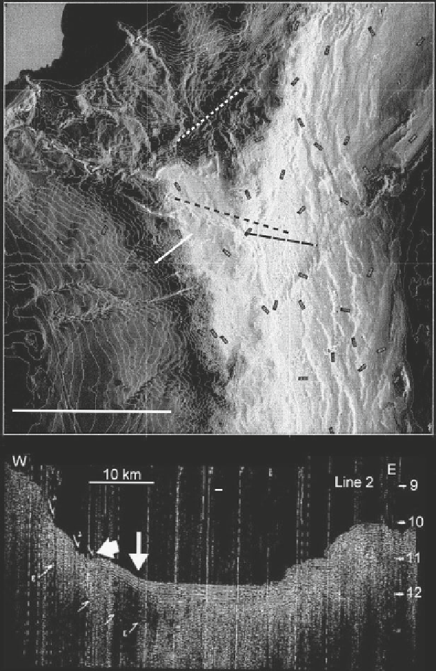
Bathymetric map of the Boso triple junction area (
top
) (Courtesy M. Nakanishi) and a
single-channel seismic profile across the triple junction (
bottom
) (Line 2 of JAMSTEC cruise
KH86-5, location shown above). The vertical scale on the profile is two-way travel time. The
nar-
row arrow
indicates the dive site of the ROV
KAIKO-10K
and the
broad arrow
indicates a subma-
rine landslide (Adapted from Ogawa et al.
1989
). The dive area is immediately north of the
Mogi
Fan
near the triple junction. The
black dotted line
northwest of the
Katsuura Basin
shows the strike
of normal faults identified by Iwabuchi et al. (
1990
). The
Katsuura Basin
is a ponded basin contain-
ing a thickness of at least 7,000 m of sediments dammed by the present-day accretionary prism
Search WWH ::

Custom Search