Geoscience Reference
In-Depth Information
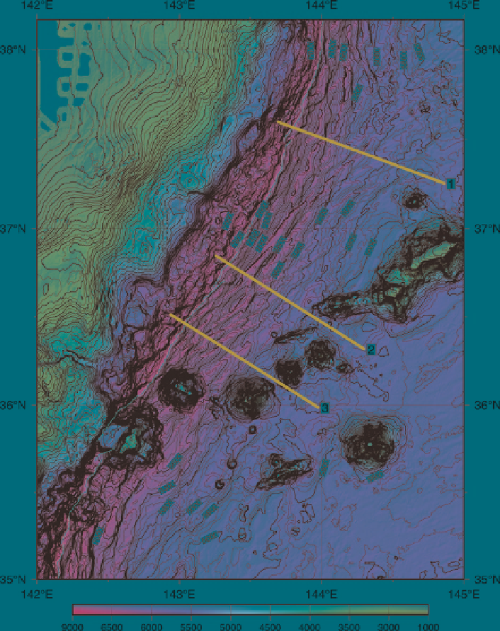
Fig. 13
Shaded bathymetric map of the southern Japan Trench.
Red lines
show positions of the
profiles in Fig.
14
. Other conventions are identical to Fig.
7
the triple junction, Mogi Fan, is very flat. Previous works indicated thick sediment
transported along Sagami Trough there (Ogawa et al.
1989
). The strike of the Izu-
Ogasawara Trench is almost N-S in the study area except for north of 35°10¢N and
33°-33°30¢N. Those north of 35°10¢N and between 33°N and 33°30¢N strike
N25°E and N10°W, respectively. The Mogi Seamount is subducting at 32°45¢N.
The height of the seamount is about 4,200 m, which is larger than that of the
Search WWH ::

Custom Search