Geoscience Reference
In-Depth Information
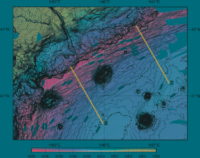
Fig. 7
Shaded bathymetric map of the western Kuril Trench. Contour interval is 50 m.
Red lines
show positions of the profiles in Fig.
8
.
Yellow lines
show the approximate location of trench axes
and ridges is less than 20 km. The bending-related topographic structures are
limited to areas less than 70 km away from the trench axis (Fig.
8
). Ridges and
asymmetric grabens, that is half grabens tilted toward the trench, are more promi-
nent than escarpments in the oceanward slope of the western Kuril Trench. The
height does not show a gradual change. The height of ridges 20 km away from the
trench axis is less than 100 m while those near the trench axis are more than 100 m.
The bending-related topographic structures 80 km beyond the trench axis have a
height of a few tens of meters, which is comparable to that of abyssal hill fabrics.
Oceanward-dipping escarpments are more common than landward-dipping
escarpments east of the Takuyo-Daiichi Seamount (Fig.
9
). West of the seamount,
landward-dipping escarpments are roughly equal to oceanward-dipping escarp-
ments. Several escarpments with an N-S strike are identified south of the Erimo
Seamount at the northern tip of the Japan Trench.
3.3.2
Japan Trench
The strike of the Japan Trench bounded by Daiichi-Kashima and Erimo seamounts
changes at around 38°N from about N08°E in the northern part to ~N30°E in the
Search WWH ::

Custom Search