Geoscience Reference
In-Depth Information
JAPAN
34N
34N
Kumano
33N
33N
km
0
50
100
32N
32N
135E
136E
137E
138E
b
136°28'30"E
136°29'00"E
D754C1
D744C3
33°07'30"N
33°07'30"N
D685C4
PC08
D752C2
D756C1
D674C4
D674C5
D744C1
D674C1
D674C3
33°07'00"N
33°07'00"N
D685C1
km
0
0.5
136°28'30"E
136°29'00"E
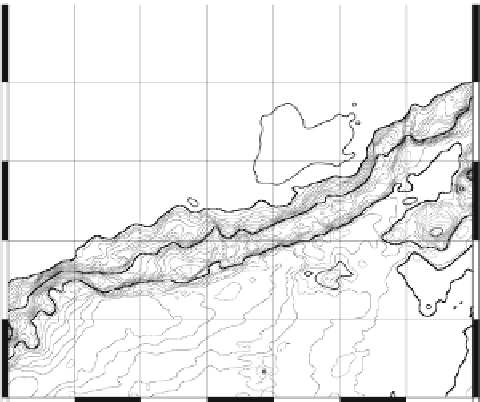
Fig. 1
(
a
) Map showing Oomine Ridge in the Nankai Trough. Oomine Ridge (
star
) is located at
33°7.32¢N, 136°28.75¢E. (
b
) Map showing the sites of cores from Oomine Ridge used in this study,
together with the sampling sites of Toki et al. (
2004
). Contour interval is 50 m.
Shaded area
repre-
sents the area where we observed many bacterial mats scattered at intervals of several hundred
meters at water depths ranging from 2,500 to 2,550 m.
Star
show the position where the core sample
was taken in the present study (PC08).
Circles
denote the positions where core samples include low-
Cl fluids in the sediments, but not triangles, as described in detail in Toki et al. (
2004
)


Search WWH ::

Custom Search