Java Reference
In-Depth Information
historic age we are interested in offering a comprehensive view of the settle-
ments in terms of cities founded by the Romans, main communication
routes in the Italian peninsula, and the regions occupied by “barbarians”,
i.e. not yet under Roman control. Students should be allowed to select a
specific historic age and interactively browse the information associated
with each settlement's indicator (e.g. cities, routes, regions). Typical pieces
of information are the following:
A city is described in terms of the year of its foundation or occupation
year, name given by the Romans, number of inhabitants, extent, size of
the military settlement, etc.
■
A route lists the linked cities, indicates the distance of each city from the
origin, the name of the council or emperor that ordered its construction,
the year of construction, etc.
■
A region is associated with information about the culture of the people
who were occupying it before the advent of the Roman civilization, i.e. the
name, the religion, the language, etc.
■
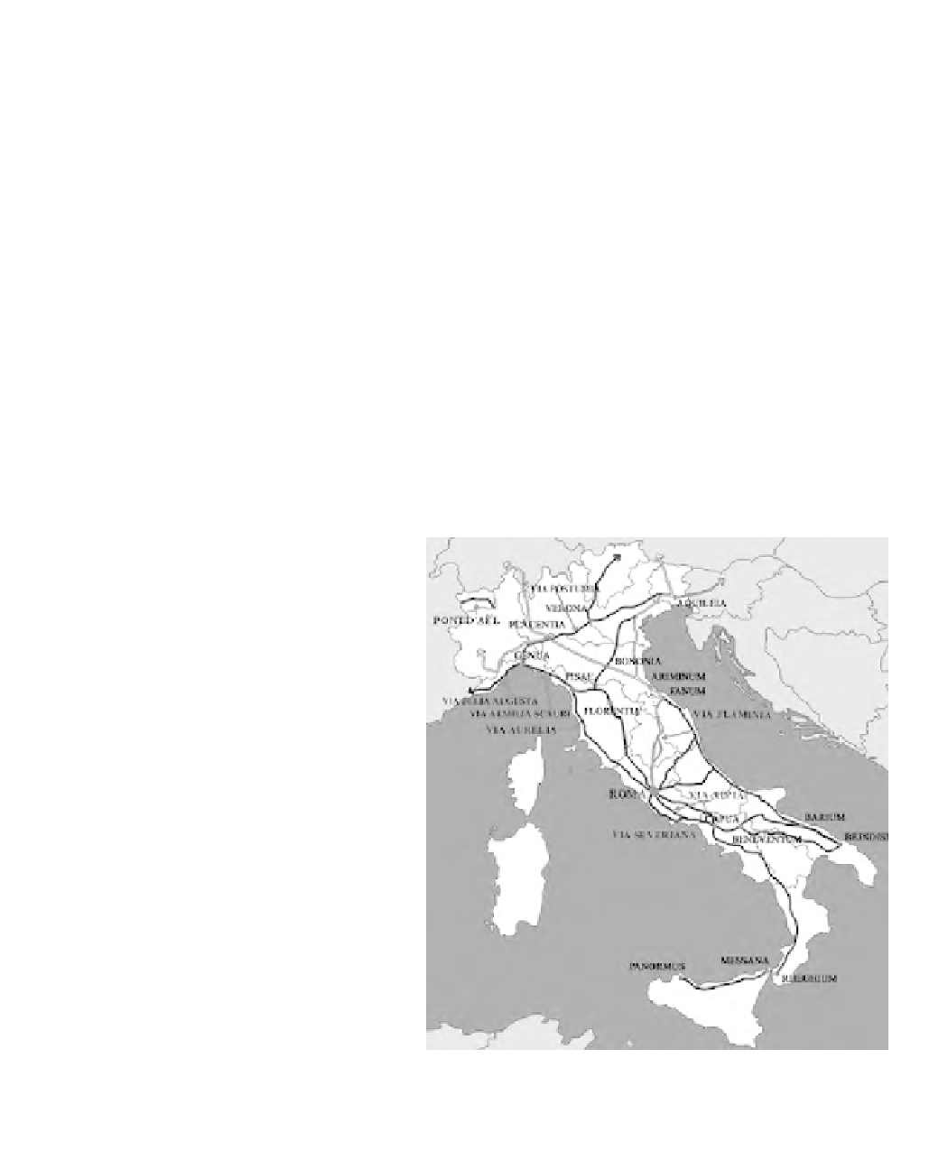
Figure 15.1 shows an example of a cartographic map that indicates the
cities and roads in the Italian peninsula during the age of the first emperors.
The interactive web service should also offer the possibility of displaying
for each temporal age only a subset of the settlement indicators, i.e. only
The network of Roman roads was set up in
Republican times when the oldest road, Via
Appia (330 BC), was built. It links (still
today) Rome with Brindisi on the Adriatic
Sea via Capua, Benevento and Bari. In the
same period were built the Via Aurelia
(241 BC) from Rome to Genoa and
subsequently up to Arles in Provence, the
Via Flaminia (232 BC) from Rome to Rimini
through the Umbria region, and the Via
Emilia (109 BC) from Rimini to Milan
through Bologna. A number of roads linked
the Italian network to the provinces. The
incredible network of 100,000 km of road
(more than seven times the equatorial
circumference of the Earth) was completely
paved in order to allow fast transfer of
military troops and to facilitate commercial
exchanges. The average pace was around
35 km per day. The network stretched over
the entire Mediterranean basin and into a
large part of Europe, and was implemented
during the Empire. Augustus completed the
Italian network. Tiberius created the
African network, Trajan built the Balkan
network and Hadrian worked towards the
creation of the British network.
Figure 15.1
A cartographic map that shows the Roman roads in the Italian peninsula