Environmental Engineering Reference
In-Depth Information
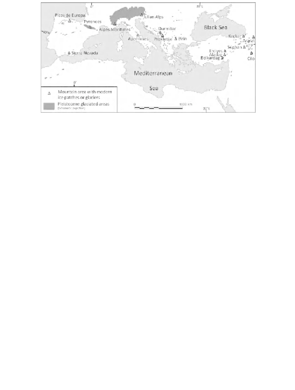
Figure 3.1
The extent of past Pleistocene glaciers in the Mediterranean mountains showing the
locations of surviving (or recently extinct) modern-day glaciers and ice patches in the twenty-first
century. Reproduced from Hughes (2011), with permission
erratics. The pioneer phase continued for decades through the twentieth century
and glacial research in the Mediterranean was particularly active in the inter-war
period between 1920 and 1940. For example, numerous papers were written on the
glacial landforms of the High Atlas of Morocco during the 1920s (Martonne, 1924;
Celerier and Charton, 1922; 1923) whilst several papers on the glacial landforms of
Greece and the Balkans were also published in the inter-war period (Maull, 1921;
Louis, 1926, 1930; Nowack, 1929; Sestini, 1933).
Some early glacial scholars, such as Cvijic (1913) and Sawicki (1911), went be-
yond this pioneer phase and mapped glacial landforms on geomorphological maps.
Hughes
et al.
(2006a) identified this development as the 'Mapping Phase'. How-
ever, many of the early geomorphological maps were basic and presumed that all
of the glacial features formed during one ice age event. Furthermore, the transition
between pioneer phase research, whereby researchers may have depicted glacial
features on simple geomorphological maps, and mapping phase research, whereby
researchers produced 'more detailed' geomorphological maps, is not always clear.
Scale and coverage are important criteria, in addition to detail, and papers present-
ing glacial geomorphological maps covering the whole, or large parts, of a massif
at scales of 1:100 000 or less can be considered to be in the mapping phase. The
pioneer phase was largely complete for most areas of the Mediterranean by the
end of the 1930s yet the mapping phase took much longer to complete, and in
some areas is yet to be completed. Also, the level of detail provided in published
works of the mapping phase is highly variable, with some studies simply mark-
ing moraines and cirques whilst others identify a range of glacial features and also
recognize different phases of glaciation and subdivide different landforms within a