Environmental Engineering Reference
In-Depth Information
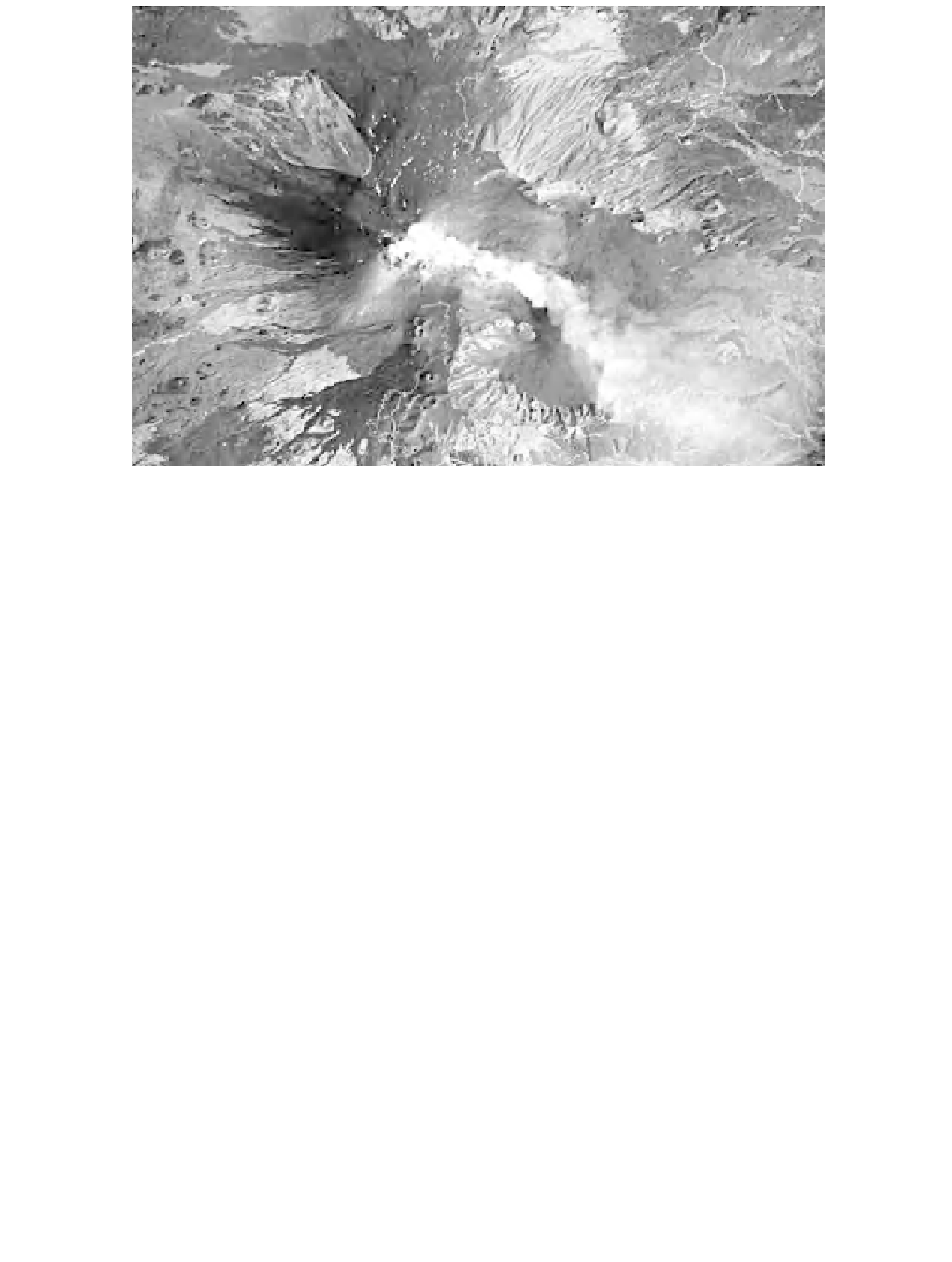
Figure 4.7
Mount Etna. Astronaut photograph ISS013-E-62714 was acquired on 2 August 2006
with a Kodak 760C digital camera using an 800 mm lens, and is provided by the ISS Crew
Earth Observations experiment and the Image Science & Analysis Group, Johnson Space Center
(http://earthobservatory.nasa.gov/). (
A full colour version of this figure appears in the colour plate
section
)
northeastern parts of its volcanic apparatus (Acocella
et al.,
2003]. Following the
eruptions of 2001 and 2002-03, several new eruptive centres along the southern and
eastern slopes of the north were created, from which escaped significant volumes
of pyroclastic material (Behncke and Neri, 2003; Andronico
et al.,
2005). The ash
and lapillis formed a covering stretching entirely to the top of the volcano, giving it
the appearance of a large and homogeneous dark surface. The recent eruptions have
also resulted in substantial changes to many of the flows on Mount Etna, especially
those closest to the new eruptive centres.
The climate of the Mount Etna area is characterized by an annual mean temper-
ature of 13-18
◦
C and annual mean rainfall of 800-1400 mm. The climate is there-
fore classified as Mediterranean and/or Mountain Mediterranean. These conditions
cause soils to have a moisture regime ranging from Xeric to Udic and a temperature
regime ranging from Thermic to Mesic.
The soils of Mount Etna vary largely taxonomically, depending on the mineralog-
ical composition of the volcanic bedrock, land cover and on morphological aspects
such as the inclination of slopes. Soils on flat surfaces of the basalt lava plateaus
often show a deep and poorly differentiated profile. They are mainly classified as