Travel Reference
In-Depth Information
Location
Randolph and Pendleton counties
Endpoint
Forest Service Road 19 in Monongahela National Forest
Mileage
5.5
Roughness Index
3
Surface
Dirt
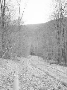
The South Prong Trail is a remote, rugged rail-trail that offers a moderate, though
sometimes quite hilly, hike. There are two very distinct sections of this trail; one sec-
tion is boggy, while the other is steep and forested.
Traversing the Flatrock Plains and Roaring Plains of Monongahela National
Forest, this trail follows old logging corridors for part of its route. The western end
follows approximately 3 miles of terraced rail beds along a flat corridor for a short
while before heading uphill, or downhill, to the next terrace of rail beds, located al-
most vertically 15 to 25 feet below or above you.
Rhododendron groves line this trail.