Geography Reference
In-Depth Information
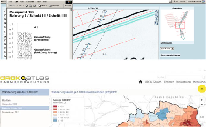
Fig. 1 Examples of Internet-based information systems with spatial content from 2002 (above)
and 2013 (below)
place in the transition from technology driven applications towards user-centred
products. Recent applications can build on contemporary technical features and
utilize the full framework of modern Internet functionalities (Fig.
1
).
Apart from that and probably even more important is the positioning of the user
within the centre of attention throughout the whole planning and development
process. This fact is in such a way important, since cartographic information
communication in the Internet has very special prerequisites and characteristics
that sets it apart from other online content processing. Online cartographic infor-
mation must be seen as independent and thus be treated with special methodologies
of usability testing.
Over the past years, findings from several online cartographical implementations
at the IfGR led to a series of lessons learned, which were considered in recent
developments to increase the usability of these latest cartographic information
systems.
What
s So Special About Online Cartography?
'
The term “geographic information system” is widely used for all systems that store,
process and visualize spatial data. This definition is particularly to be found in
English-language literature in which GIS has established itself as a self-evident
term, as it is used in Lloyd et al. (
2007
), Haklay and Zafira (
2008
) and Skarlatidou
et al. (
2011
). The term
GIS
stands in these publications in a general context for all
'
'