Geography Reference
In-Depth Information
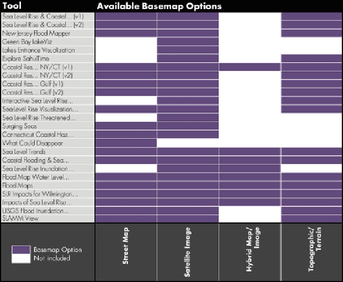
Fig. 4 Available Basemap Options
Basemap and Overlay Context Information
Provision of context information is essential for successful interpretation of the
waterline or flood extent. Traditionally, the relative importance of different map
features was communicated to the map user through a carefully designed
visual
hierarchy
(Slocum et al.
2009
); in the case of a water level visualization, the
position of the waterline should rise to the forefront to ensure immediate visual
inspection, with other context information receding into the background. The
possibility of interactivity, along with historical constraints in web mapping techno-
logy, have transformed this traditional paradigm, with context information typically
organized into
basemap
versus
overlay
layers for maps published online. Typically,
the basemap layers are rasterized and served as a set of tiles to support instan-
taneous panning and zooming, while the overlays are drawn as vectors to enable
retrieval of additional details about the features.
Figure
4
provides an overview of commonly available basemap options. The
competitive analysis identified four basemap layers commonly available in water
level visualization tools: satellite or aerial images (24/25; 96 %), street maps
(19/25; 76 %), a map-image hybrid that includes labels and some vector features
(8/25; 32 %), and a topographic map or other terrain representation (18/25; 72 %).