Geography Reference
In-Depth Information
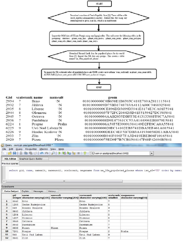
Fig. 1 Starting procedure for joining NE, Geonames and OSM for CZ places, their attributes and
tabularization
spatial reference system and hence makes them comparable. Next, to work on
joining these datasets, we use a Python script to connect to the postgis database.
From the NE table ne_10m_populated_places, fetch all records available for Czech
Republic. We fetch only the required columns in the above rows in Fig.
1
so as to
avoid unnecessary memory wastage. The important columns are the various fields