Geography Reference
In-Depth Information
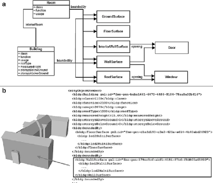
Fig. 1 Conceptual scheme of 3D model of buildings from Faculty of Science campus formed
according to CityGML in LoD 4 (a) and 3D model of buildings from the Faculty of Science
campus in CityGML format in LoD 2 and the record of this data structure in XML (b)
• define semantic classes,
• supplement information about level of detail,
• add attribute values or derive them from the geometry.
Individual steps can be performed either automatically or manually. Both
approaches were tested and their combination was used to perform the final
conversion. The conversion was carried out on two levels: 3D models in LoD
2 (see Fig.
1a
) and LoD 4 were made (the data model of this level is shown in
Fig.
1b
).
ArcGIS 10.0 software was used for manual pre-processing, which was the first
step in conversion. The extrusion of vertical surfaces (walls), the base height
definition for horizontal surfaces (surfaces of ground, floors and flat roofs) and
the completely manual creation (in ArcScene module) of complex gabled roof
surfaces were performed in this step. While processing the variant in LoD 4, 3D
versions of difference and intersect operations were also used (these algorithms are
in ArcGIS parts of 3D Analyst extension).