Environmental Engineering Reference
In-Depth Information
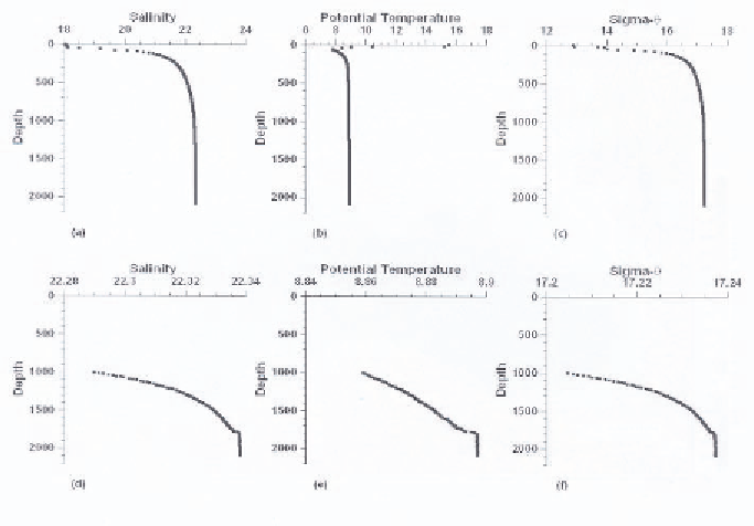
Figure 4.
Salinity, potential temperature and density (sigma-theta) from the 1988 R/V Knorr
Expedition [39]. The location is Station BS3-2 HC-20 in the center of the western gyre. a, b, c
are full water column. d, e, f show a blow up of the bottom 1000 m.
winter storms [45]. Gregg and Yakushev [17] observed in March 2003 that the
surface water had uniformly cold temperature (T = 6.1
◦
C) from the surface to
the depth (density σ
θ
= 14.5) of the CIL. The intensity and relative importance
of these two sources are probably variable on a year to year basis depending on
climatic conditions.
Most of the mixing between the Bosporus outflow and the CIL occurs on
the continental shelf just north of the Bosporus [71]. The bottom layer of
high salinity water from the Marmara Sea comes in from the south and thins
as it enters the Black Sea. Salinity gradients are sharp at its upper boundary
indicating mixing with overlying water. The overlying water is characterized
by the temperature minimum characteristic of the CIL. This mixing results in
the linear, two end-member mixing characteristics for T and S seen in Fig. 5.
Most mixing occurs before the Bosporus outflow reaches the shelf break at 200
m. The resulting Bosporus plume ventilates the interior of the Black Sea at the
depth represented by its density when it reaches the shelf break [51, 67]. The
most common entrainment conditions result in ventilation of the upper 500 m
but evidence suggests there must be occasionally rare ventilation events that
reach the bottom. We know this because the only source for relatively warm