Environmental Engineering Reference
In-Depth Information
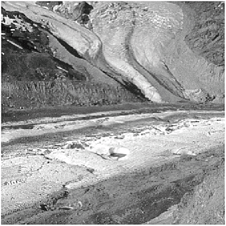
Plate 15.13
Medial and lateral moraines of the Gorner
gaciers and its tributary Schmäre and Breithorn glaciers,
Switzerland. The lateral moraines mark Little Ice Age limits
of all three glaciers, and the extent of subsequent retreat.
Photo: Ken Addison.
(subglacial stream beds) are uncommon. Beyond the glacier terminus, glaciofluvial
sediments form a
valley train
or braided
outwash plain
confined between the rock walls.
Glaciolacustrine sedimentation in rock basins and moraine-dammed depressions is a
major feature of deglaciated alpine valleys.
ICE SHEET DEPOSITIONAL LAND-SYSTEMS
Although an ice sheet may advance over 2000 km from its ice source, and subsequent
retreat, deglaciation and postglacial environments rework the landscape, the most
extensive glacier depositional landsystem is still associated with late Pleistocene ice
sheets of North America and Eurasia. The sequence and alignment of landforms, facies
and even individual clasts collectively point to the ice source regions, ice dynamics and
ice limits. They can be identified using the same zonation as for erosional landforms (see
Figure 15.9). Low erosion rates in Zone I generate little debris, and glacigenic sediment
is sparse in ice sheet accumulation areas. Many ice source regions were formerly
unrecognized because of their dearth of conventional glacial landforms. As linear erosion
develops in Zone II, deposition also becomes more significant and somewhat streamlined
in the form of fluted till. High rates of basal and sidewall erosion in the vicinity of outlet
glaciers in Zone III replicate alpine valley glaciers and greatly augment in-transit
sediment loads.