Environmental Engineering Reference
In-Depth Information
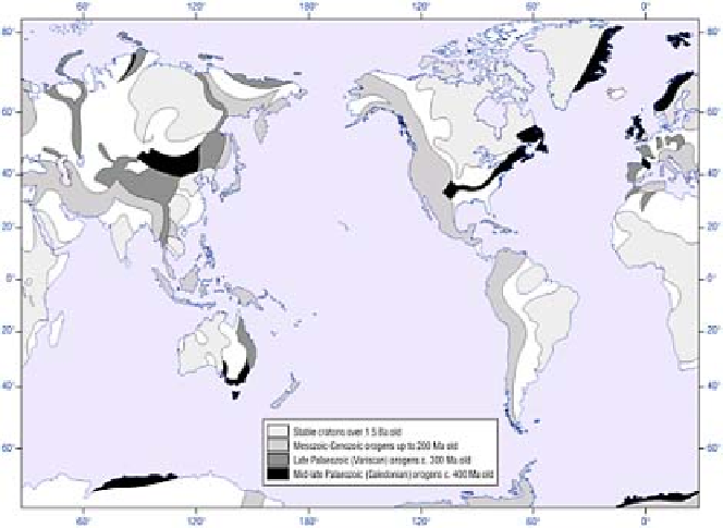
Figure 10.12
Global distribution of cratons and Phanerozoic
orogens. Most intervening areas are sedimentary basins.
Sources: After Fowler (1990) and Smith (1982).
ate
basin and range
topography, best seen between the Sierra Nevada and Rocky
Mountain ranges of the western United States (Plate 10.2), and may be accompanied by
basaltic extrusions.
Effusive
flood basalts
inundate the existing land surface and may extend over large
areas. The Mesozoic break-up of Pangaea generated large basalt flows near rifted
margins which often survive as resistant plateaux, as in parts of India (Deccan, 0·5
million km
2
), the United States (Columbia, in Washington/Oregon, 0·13 million km
2
) and
South Africa (Karroo). The Karroo flood basalts formerly covered over 5 million km
2
.
Tertiary basalts up to 5 km thick were extruded in the Irish-Hebridean basin of the
British Isles during the formation of the Atlantic Ocean, forming the modern Antrim
plateau and Fingal's Cave landmarks (Plate 10.3).
Eruptive
alkali-basalts and other
magmas form volcanoes. The largest concentration forms the East African Rift Valley
complex, with well