Environmental Engineering Reference
In-Depth Information
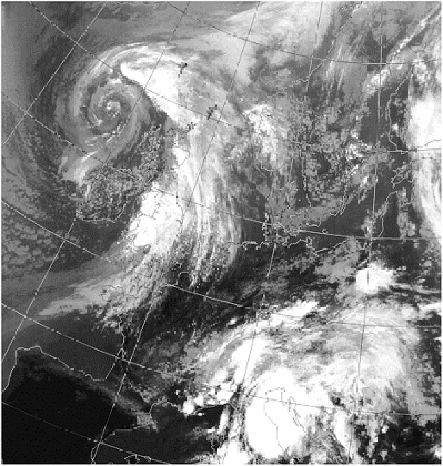
Plate 7.2
An example of the typical large spiral cloud pattern
associated with the mid-latitude cyclone. The centre of the
spiral to the north-west of Ireland, marks the position of the
lowest pressure, with the cold front clearly defined by the
band of cloud aligned approximately north-south across
England. Detailed examination of the cloud shows it is not a
simple cloud band but consists of several linear features.
Further comparison of visible and infra-red images can be
made with Plate 4.6.
Image: courtesy of the NERC Satellite Station, University of
Dundee.