Environmental Engineering Reference
In-Depth Information
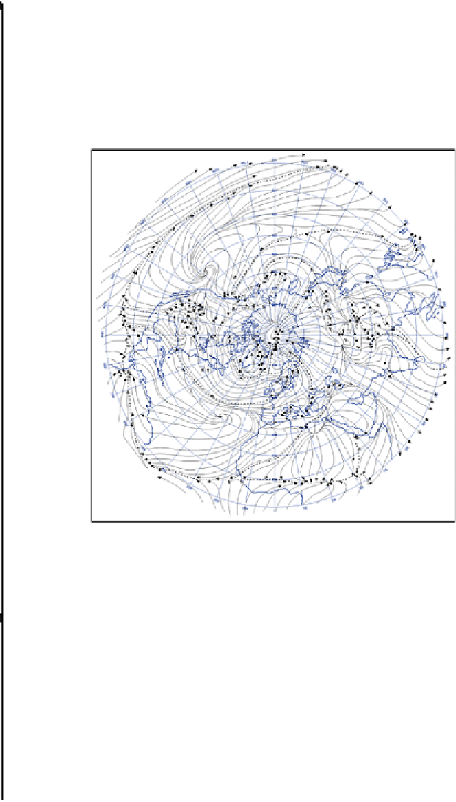
analysis. One way is to identify air movement in terms of air streams. These represent the
streamlines of the mean resultant wind in a particular area and so when mapped spatially
they are more representative of the dynamics of flow rather than the static picture
presented by the air mass concept. In many ways this gives a more realistic picture of
what happens within the atmosphere. They identify areas of divergence that are the basis
of the air mass source region and the confluence zone between air streams of different
origin (Figure 1).
Figure 1
Streamline analysis of mean January resultant wind field.
Dashed lines indicate airstream confluences.
Source: After Wendland and Bryson (1981).
A study of air streams found nineteen source regions in the northern hemisphere, but
not all of them were present in all months. Four regions dominated in terms of their area
of influence. Inevitably these are associated with the subtropical anticyclones that also
form the basis of air mass source regions. However, the study of air streams also involves
their subsequent movement.
Climatologists have found that the extent of the various air streams is often
sufficiently stable throughout the year for the boundaries between air streams to mark the
average position of fronts. These airstream meeting zones are termed confluences. One
distinguishing feature of air streams can be their very different moisture content. Within
an air steam the temperature and moisture content can be relatively uniform
Where a