Environmental Engineering Reference
In-Depth Information
Aboriginal Trail Network of the Salish,
Pend d “Oreille and Kootenai People
Continental
Divide
Canada
Idaho
Yellowstone
Park
Wyoming
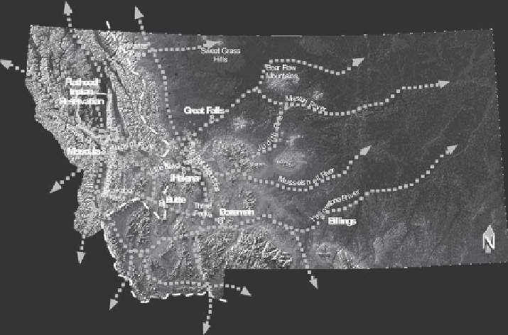
FIGURE 17.4
Historic geographic range of the Rocky Mountain Plateau peoples.
l
andsCaPe
C
hanges
i
imPaCting
C
UltUral
v
alUes
The ecocultural landscape of western Montana has been greatly modified over the
last 150 years. The 1855 Hellgate Treaty established the Reservation, and expedited
the conversion of landscape and culture from a traditional subsistence lifestyle to
agrarian, homestead settlement. The 1910 Allotment Act formalized this transition
by parceling the Flathead Indian Reservation into 110- or 220-acre allotments for
individual tribal members to farm. Today this legacy in terms of issues of govern-
ment and fragmented land ownership makes large-scale ecological planning very
challenging (Figure 17.9).
During the last century agriculture and grazing have replaced prairies, forests,
and riparian areas. The extensive irrigation canals and drainage systems developed
to establish agriculture in this landscape significantly modified the hydrology, which
in turn affected vegetation, water quality, and wildlife habitat (Figure 17.10).
One of the biggest intrusions on the landscape was the 1930s construction of U.S.
Highway 93, a roadway that slices its way through the middle of the Reservation
(Figure 17.11).
With each subsequent improvement, the road became wider, flatter, and straighter.
These improvements allowed more traffic to move faster along the roadway, but
they also required the road alignment to ignore local landform variations, cutting
into hillsides and filling low-lying areas. The predecessor road was therefore an
affront to the land as it sliced through ponderosa pine savannas and cut off rivers
and streams from their floodplains (Figure 17.12). It was a straight line bisecting
Search WWH ::

Custom Search