Environmental Engineering Reference
In-Depth Information
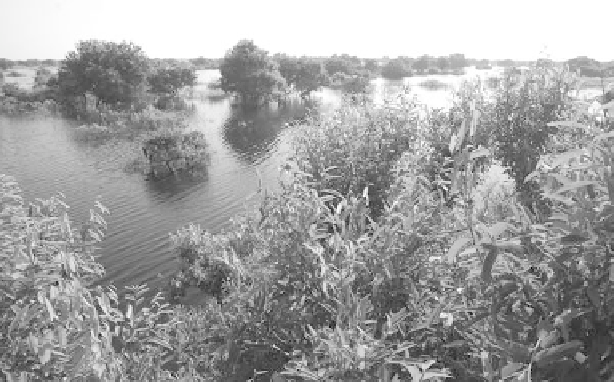
FIGURE 14.2
The submerged forest in Tonle Sap Lake.
largest concentration of religious buildings. Since 1992, the ruins have been managed
within the 40 km
2
Angkor Archaeological Park, a World Heritage cultural site.
The Khmer Empire, like those in ancient Mesopotamia, was based on mas-
sive hydroengineering projects. Angkor has been referred to as a “hydraulic city”
due to the dominating presence in the landscape of centralized storage reservoirs
(Figure 14.6) which were also used for transport, aquaculture, and ritual. The multi-
functional water management scheme also included many kilometers of canals (for
transport and drainage) such as the one that leads from the Angkor ruins through
Siem Reap to the lake and that today is referred to as the Siem Reap River. And, as
in southern Mesopotamia, there is evidence that anthropogenically produced envi-
ronmental problems may have contributed to a collapse in the Khmer Empire, in this
case not due to overirrigation and salinization (see chapter 21) but to deforestation,
erosion, and siltation, which progressively destroyed the water management system.
With an area of almost 77,000 km
2
(Anonymous 2004), the Tonle Sap drainage
basin extends over 44 percent of Cambodia's land area (Figure 14.1) and is home to
32 percent of its population (ADB 2005c). No wonder, then, that the Great Lake is,
like the Iraqi marshlands (Al-Khayoun 2007) and Mexico's Xochimilco (chapter 11),
an inseparable and deep-rooted part of the very cultural identity of the nation.
The most striking parallel to the situation in the marshlands of southern Iraq are
the tens of thousands of people living in what are referred to as “floating villages” on
the Tonle Sap Great Lake. At one time most of these people were ethnic Vietnamese
who, like the marshland dwellers in Iraq (Nicholson 2007), were regarded with hos-
tility by the majority and referred to by derogatory names (Palmer and Martin 2005).
There are over 150 villages around the lake, most consisting of a mixture of houses
built on pontoons made of bamboo mats, metal drums, or boat hulls which are flush
with the water level of the lake during the wet season but stand up on their stilts
when levels recede (Figure 14.7). Several of these houses are hooked up to com-
munication and television towers and have outside pens for keeping livestock and
Search WWH ::

Custom Search