Environmental Engineering Reference
In-Depth Information
Eurasian Plate
Eurasian Plate
North American Plate
CASCADE
-RANGE
-San Andreas
Fault
Aleutian Trench
Mid-Atlantic
Ridge
“
Ring of Fire
”
Arabian
Plate
Hawaiian “Hot Spot”
Cocos Plate
East Pacific
Rise-
Java Trench-
Nazca
Plate
South
American
Plate
African Plate
Indo-Australian Plate
Pacific Plate
Antarctic Plate
USGS
FIGURE 2.1
The major tectonic plates of the world. (From United States Geological Survey, World map showing plate bound-
aries and active volcanoes, http://vulcan.wr.usgs.gov/Glossary/PlateTectonics/Maps/map_plate_tectonics_
world.html (accessed June 18, 2010), 2010a.)
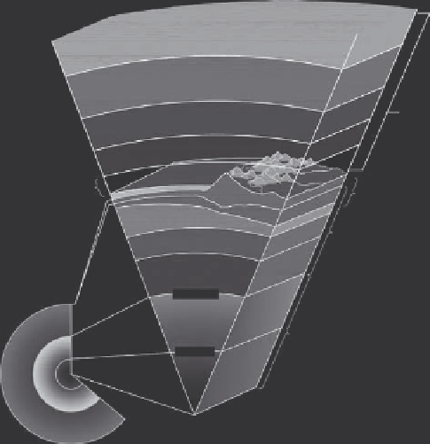
Exosphere
Thermosphere
Atmosphere
Mesosphere
Stratosphere
Lithosphere
(crust and upper
most solid mantle)
Troposphere
Crust 0-100 km
thick
Asthenosphere
Mantle
Mantle
Crust
2900 km
Not to scale
Liquid
Core
Outer core
5100 km
Solid
Inner core
6,378 km
To scale
FIGURE 2.2
(See color insert.)
Cross section of the interior portions of the Earth showing the asthenosphere. (Modified
from Kious, W.J. and Tilling, R.I.,
The Dynamic Earth: The Story of Plate Tectonics,
United States Geological Survey,
Governmental Printing Office, Washington, DC, 1996.)


Search WWH ::

Custom Search