Environmental Engineering Reference
In-Depth Information
Fort Wayne Moraine (Qmf)
Defiance Moraine (outer ridge) (Qmdo)
Defiance Moraine (inner ridge) (Qmdi)
Birmingham Moraine (Qmb)
Birmingham Water Laid Moraine (Qmbw)
Glacial outwash (Qow)
Eskers (Qme)
Kames (Qmk)
Kettles (Qmt)
Delta (Qmd)
Glacial-lacustrine (sandy clay) (Qla)
Glacial-lacustrine (sand) (Qls)
Glacial-lacustrine (sandy and silty clay) (Qll)
Glacial-lacustrine (upper clay) (Qlc)
Legend
Rouge watershed boundary
County boundaries
City/township boundaries
Highways
County roads
Rouge River major branches
Tributaries
Enclosed drains
Glacial-lacustrine (beach or beach ridges)
Maumee glacial lake stage (Qma)
Whittlesey glacial lake stage (Qws)
Wayne glacial lake stage (Qwa)
Grassmere glacial lake stage (Qga)
Lundy glacial lake stage (Qlu)
Early Algonquin (Qlq)
Recent fluvial deposits
(Rouge River)
1
10 km
N
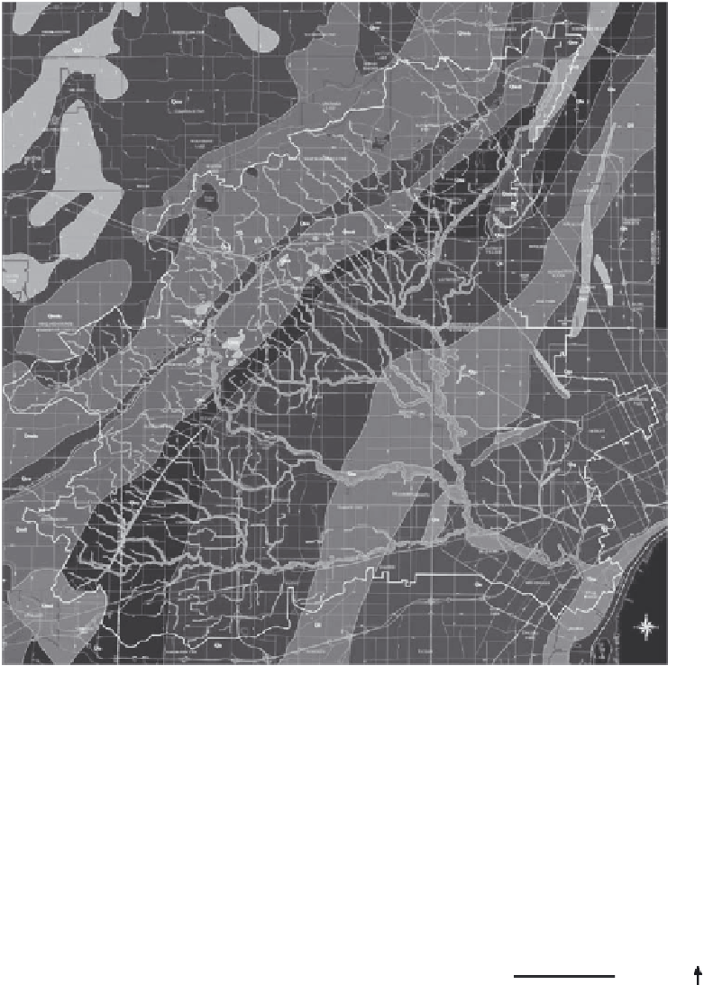
FIGURE 5.20
(See color insert.)
Geologic map of the Rouge River watershed produced using GIS. (From Rogers, D.T., Surficial
geologic map of the Rouge River watershed in southeastern Michigan, Wayne County, MI, Map Scale 1:62,500,
2 Sheets, 1997.)


Search WWH ::

Custom Search