Environmental Engineering Reference
In-Depth Information
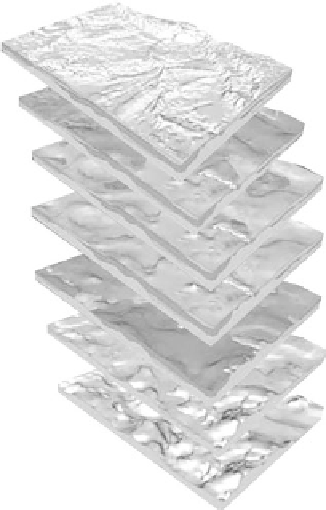
FIGURE 5.19
Example of GIS layered mapping capability. (From United States
Geological Survey, Topographic mapping, Online edition, http://
egsc.usgs.gov/ish/pubs/booklets/topo/topo.html, 2010c.)
5.3 Summary and Conclusion
In this chapter, we have introduced the concept of “forensic geology” and discussed many
unique circumstances that offer the geologist valuable opportunities to observe and col-
lect geologic information in urban settings. This information can supplement and confirm
geologic findings gathered onsite and on file from local and state regulatory agencies.
These data can be used to develop urban environmental investigations in a short period
of time and at low cost. By combining fieldwork with other sources of geological informa-
tion, a detailed geologic map of any urban watershed in the United States can be produced.
Geologic mapping in urban areas requires a special skill set: a thorough geologic knowl-
edge of near-surface sedimentary environments; the ability to identify the differences
between natural and anthropogenic deposits; knowledge of the urban landscape; aware-
ness and expertise in the methods used for obtaining access to sites of interest and informa-
tion sources; and the facility to use a simple and expressive system to display the concepts
and processes. Of these skills, the most critical, other than getting the geology right, is the
presentation of data. Even the most detailed information database is rendered useless if it
cannot be effectively and easily communicated. The use of multiple maps designed to add
geologic knowledge and complexity through time, used alone, or coupled with GIS and
three-dimensional mapping techniques, also helps simplify the communication of com-
plex information. In addition, these tools can integrate geological information with other
useful forms of information for the intended audience.
After obtaining a detailed understanding of urban geology and hydrogeology, the next
step in evaluating the sustainability of a watershed can begin. This involves organizing
the geologic and hydrogeologic information and bringing in other important data sources
to construct a geologic vulnerability map—the subject of the next chapter.
Search WWH ::

Custom Search