Environmental Engineering Reference
In-Depth Information
Contour
line
Buildings
River
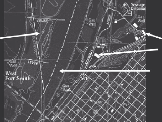
FIGURE 5.13
Portion of 7.5 min USGS series map of Fort Smith, Arkansas. (From United States Geological Survey, Geographic
information system, USGS, Washington, DC, http://egsc.usgs.gov/ish/pubs/gis_poster, 2010b.)
• Elevation contours are present to assist with the identification of geologic units
and help establish formation boundaries.
• Many land features of interest to geologists are identified.
• Anthropogenic features such as developed areas, roads, and parks are identified.
• Natural features such as lakes, rivers, streams, forested areas, and points of inter-
est are identified.
• Each map is well labeled.
• Coordinates of longitude and latitude are present on each map.
• Magnetic declination is included on each map.
• The location of springs and wells are located on many maps.
• Information can be easily transferred to other mapping technologies such as geo-
graphic information systems (GIS) and three-dimensional maps.
• Many maps are available electronically, so areas with complex geology or areas
requiring finer resolution can be mapped using larger cartographic scales.
Figure 5.13 presents a portion of a 7.5 min USGS series map.
5.2.8 Final Draft Map Preparation
Over 100 years ago, John Wesley Powell stated that “maps are designed not so much for
the specialist as for the people.” He elaborates more on this topic (and we paraphrase here)
by saying the system of convention selected should be simple and expressive, so the con-
cepts and processes depicted can be easily understood. Conveying geologic information
with the simplest of terms is difficult and challenging, because the information is often
very complex. Do not despair—there are several methods available to allow an effective
Search WWH ::

Custom Search