Agriculture Reference
In-Depth Information
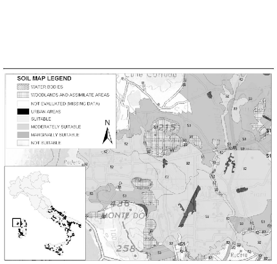
Urban areas, Woodland areas and making like (stable grassland, Mediterranean
garigue, riparian vegetation), and water bodies have been also included in the soil layer,
but not evaluated because of missing or not sufficient soil data.
In the first step the Consortium area is divided in different suitable classes (see
Figure 6).
Figure 6. Nurra Consortium irrigation suitability to sprinkler technique and soil map
(Sardinia - about 1:75.000 scale)
The National Soil Database (from the Experimental Institute for Soil Study and
Conservation - ISSDS, Costantini et alii, 2003) is the basis adopted to the irrigation
suitability evaluation. The United States Bureau of Reclamation methodology, modified
by the ISSDS during the project POM INEA in the southern regions (POM
IRRIGAZIONE, 1998-2002), has been adopted for the evaluation procedure.
Several soil features and qualities have been taken in account to evaluate the
irrigation suitability, (referred to both surface and internal soil). A matching table defines
the type of limitation in rows and the suitability class in column. The maximum limitation
criteria (the strongest limitation determines the suitability class) has been utilised to
evaluate all the soil type. The soil characteristics/parameters, for both topsoil and subsoil,
are listed in Table 6. For the slope classes, the main irrigation techniques (drop, sprinkler
and flowing) thresholds have been adopted.


Search WWH ::

Custom Search