Agriculture Reference
In-Depth Information
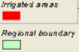
Figure 1. Irrigated areas in Objective 1 Italian Regions
2. Materials and methods
The methodology applied is articulated in several steps, as in the following
paragraphs.
2.1 Irrigated areas (administrative boundaries) identification
Land Reclamation and Irrigation Consortia are organised in two principal
administrative and physical-territorial units:
Comprensori
and
distretti
(Figure 2). The
picture). The boundaries of this administrative and physical-territorial units has been
acquired throw direct inquire beside the Land Reclamation and Irrigation Consortium.
The cartographic support present in the Consortia archive — normally available in
hardcopy — has been acquired in digital format, georeferenced and then drawing in
vector format inside a GIS system. Some alphanumeric attribute has been linked to the
geometric feature regarding information on irrigation characteristics of the above-
mentioned unit, such as the topographic, potentially irrigated and actually irrigated
surface, types of crops present inside the units, etc.
All data have been aggregated at
Comprensorio
level (256
Comprensori
in the whole study area).
2.2 Irrigated crop georeferenced database
The evaluation of water volumes needs the following very detailed information:
detailed land use on a level suitable to distinguish the single cultural species;
crop water requirements for the different crops;
irrigation techniques;
water costs.


Search WWH ::

Custom Search