Travel Reference
In-Depth Information
Fortaleza
Abáre
Curaçá
Macururé
#")*"
Glória
Petrolina
Juàzeiro
Paulo
Afonso
Recife
Formosa
Massaroca
CANUDOS
Uauá
Jeremoabo
KEY
Senhor do
Bonfim
Euclides
da Cunha
Area illustrated
Campo Formoso
Cícero
Dantas
Queimadas
Tucano
Jacobina
Cipó
Nova
Soure
Aracaju
Mangue Seco
Conceição
do Coité
Jacu
Serrinha
Esplanada
Mairi
Inhambupe
Alagoinhas
LINHA VERDE
Feira de
Santana
Ipirá
Pojuca
Porto Sauípe
CACHOEIRA
SANTO AMARO
Itaberaba
Camaçari
SÃO FÉLIX
Iaçu
SALVADOR
Amargosa
ILHA DE
ITAPARICA
MORRO DE SÃO
PAULO
Maracás
Santa
Inês
Jequié
Camamu
PENINSULA
DE MARAÚ
Manuel
Vitorino
Marau
Ipiaú
ITACARÉ
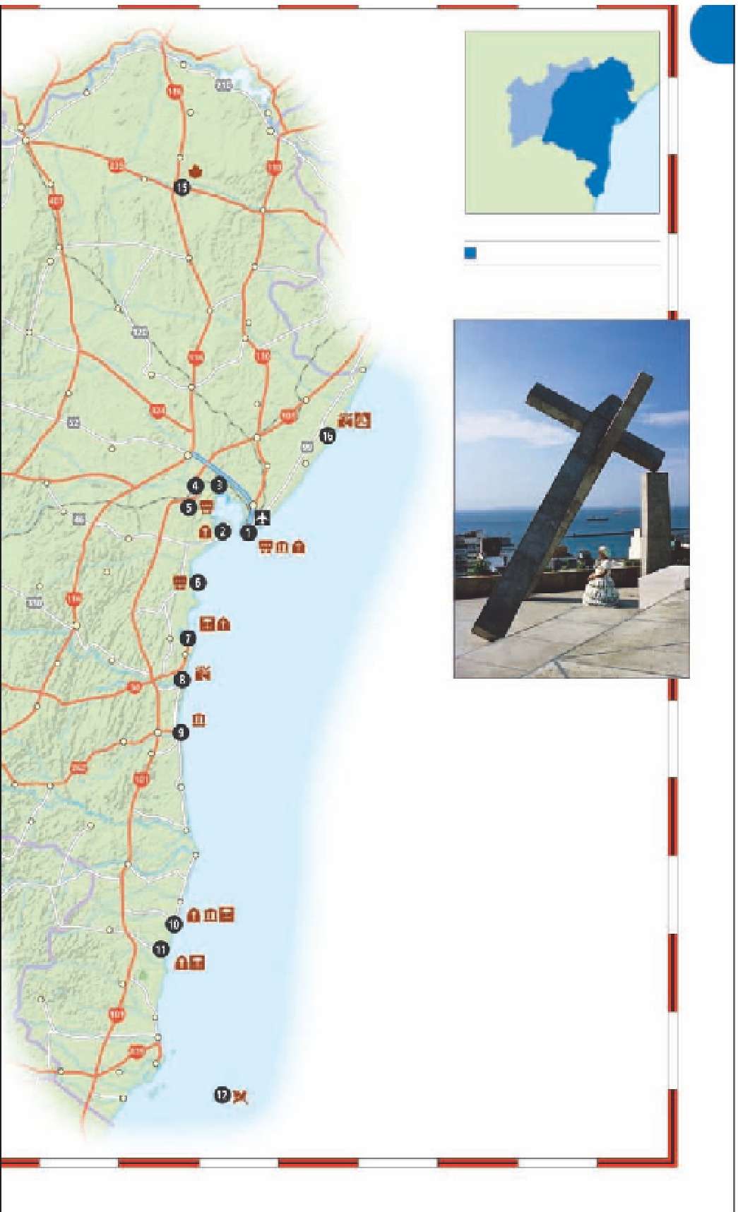
A Baiana under Mario Cravo's
towering
A Cruz Caida
Poções
Itabuna
ILHÉUS
Ibicaraí
Buerarema
SEE ALSO
• Where to Stay
pp376-8
• Where to Eat
pp401-403
Una
Itapetinga
Itambé
Potiraguá
Canavieiras
Macarani
Itapebi
Belmonte
GETTING AROUND
Bahia is large, and the roads are mostly precarious.
However, the Linha Verde (BA-099), which runs north
along the coast from Salvador to the border with
Sergipe, provides easy, quick access to the beach
towns. Traveling south from Salvador, the BR-101
runs parallel to the coast, about 37 miles (60 km)
inland. Access to beach towns on the southern coast
is via secondary roads. The best way to get around
is to fly to one of the major destinations, such as
Salvador, Ilhéus, or Porto Seguro, and proceed by bus
to explore the surrounding regions. The main
destination inland, the Chapada Diamantina, is a drive
from Salvador on the BR-324, BR-126, and BR-242
highways. Lençóis in the Chapada Diamantina can be
reached by road and plane.
Santa Cruz Cabrália
PORTO SEGURO
Guaratinga
TRANCOSO
Itamaraju
Monte Pascoal
1,758 ft (536 m)
Itanhém
Prado
I
Alcobaça
Ibiranhém
Caravelas
Helvécia
Mucuri
Vitória,
Rio de
Janeiro
PARQUE NACIONAL
MARINHO DE ABROLHOS