Agriculture Reference
In-Depth Information
40
°
20
°
0
°
Equator
20
°
Major Wetland Area
Area with Abundant
Wetlands
40
°
160
°
140
°
120
°
100
°
80
°
60
°
40
°
20
°
0
°
20
°
40
°
60
°
80
°
100
°
120
°
140
°
160
°
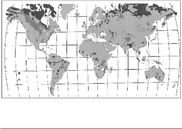
Figure 1.1
Global distribution of wetlands (Mitsch and Gosselink, 2000). Reproduced
by permission of Wiley, New York
Table 1.1
Global extent of wetlands of different types
Area (Mha)
Polar
Boreal
Temperate
Tropical
Total
Bogs
21
104
42
20
187
Fens
54
62
32
—
148
Swamps
—
1
10
102
113
Marshes
—
—
17
10
27
Floodplains
—
—
8
74
82
Shallow lakes
—
—
1
11
12
Ricefields
—
—
29
80
109
Total
75
167
139
297
678
Definitions of wetland types:
Bogs
are raised peat-producing wetlands formed in wet climates where organic material has accumulated over
long periods. Because they are raised, water and nutrients are entirely derived from the atmosphere, and they are
therefore nutrient deficient and acid. Sphagnum moss is the main vegetation, though other types of vegetation are
also present in tropical regions.
Fens
are peat-producing wetlands that receive water and nutrients through inflow from neighbouring land. They
are generally less acid than bogs and may be alkaline, and tend to be dominated by grasses and sedges. Because
of their better nutrient status they are generally more prolific than bogs.
Swamps
are forested, freshwater wetlands on submerged soils in which little peat accumulates. This is the US
definition; elsewhere the term also includes non-forested wetlands with reeds. Swamps tend to form in warmer
climates.
Marshes
are herbaceous freshwater, non-peat-producing wetlands dominated by grasses, sedges or reeds. The
distinction between swamps and marshes may be blurred.
Floodplains
are periodically inundated areas along rivers or lakes. Their vegetative cover is variable.
Shallow lakes
are open water bodies a few metres deep. Only considered foe temperate and tropical regions; in
polar and boreal regions it is difficult to separate shallow lakes from bogs and fens.
Ricefields
exclude upland rice. The physical area is calculated from the sum of irrigated rice (51 Mha of which
47% is double- or triple-cropped with rice and 33% under rice-wheat rotation), rainfed lowland rice (54 Mha)
and deepwater rice (4 Mha). The riceland of China is taken to be all temperate.
Sources
: Aselmann and Crutzen (1989); Huke and Huke (1997); IRRI (2002).