Geology Reference
In-Depth Information
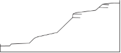
Units 1
Unit 2
Unit 3
Units 4
5
Unit 6
7
(interfluves) and 7 (alluvial toeslopes) <8°
(seepage slopes) 9°-14°
(convex creep slopes) 14°-19°
(fall face) and
(transportational midslopes) >20°
(colluvial footslopes on sandstone) 10°-20°
(colluvial footslopes on shale) 9°-14°
Rotational Complex
Block slide
Slump
earth flow
Landslide (type
undetermined)
Units 8
9
(channel wall) and
(channel bed) not shown
Geological formations
I
Superficial mass movements
I
Middle Grits
II
1.
2.
3.
4.
Kinderscout Grits
III
Grindlow Shales
IV
Shale Grit
S
5.
6.
I
II
8.
7.
T
Other features
T
T
T
F
9.
e
T
T
T
T
10.
IV
T
S
S
III
III
11.
F
d
c
F
Land-surface model
for Longdendale
S
S
b
S
S
II
S
5
3
2
1
a
6
S
3
4
5
Longdendale Reservoirs
a
b
c
N
6
Bottoms
Valehouse
Rhodeswood
d
e
Torside
Woodhead
5
7
9
8
0
1
2 km
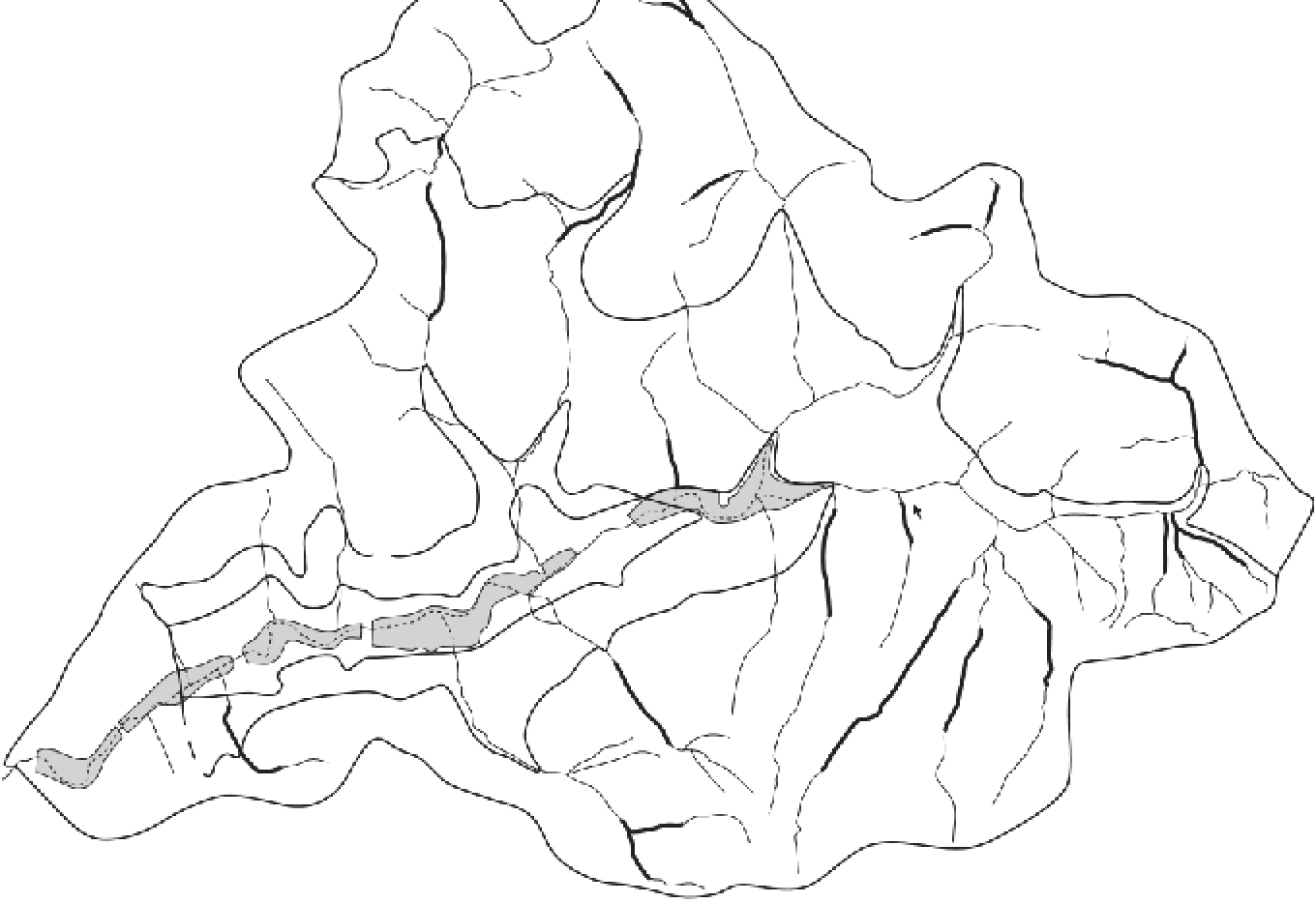
Figure 1.6
Morphological map of Longdendale, north Derbyshire, England. The map portrays units of a nine-unit land-surface model, types of mass
movement, and geological formations. The superficial mass movements are: 1 mudflow, earthflow, or peat burst; 2 Soil slump; 3 Minor soil slump;
4 Rockfall; 5 Scree; 6 Solifluction lobe; 7 Terracettes; 8 Soil creep or block creep and soliflucted material. The other features are: 9 Incised stream; 10 Rock
cliff; 11 Valley-floor alluvial fan.
Source:
After Johnson (1980)