Geology Reference
In-Depth Information
0
0°
a
D
Larsen
Ice Shelf
Weddell
Sea
D
Antarctic
Peninsula
S
Amery
Ice Shelf
Ronne
Ice Shelf
Lambert
Glacier
Dome
Argus
West
Ice Shelf
D
D
D
S
90°W
S
90°E
D
D
S
D
D
S
S
D
Shackleton
Ice Shelf
S
Amundsen
Sea
S
D
D
Ross
Ice Shelf
D
D
500 m bathymetric contour
Ice divide
Dome
Saddle
Ice shelf grounding line
Mountains above ice sheet
Ross
Sea
S
D
D
S
180°
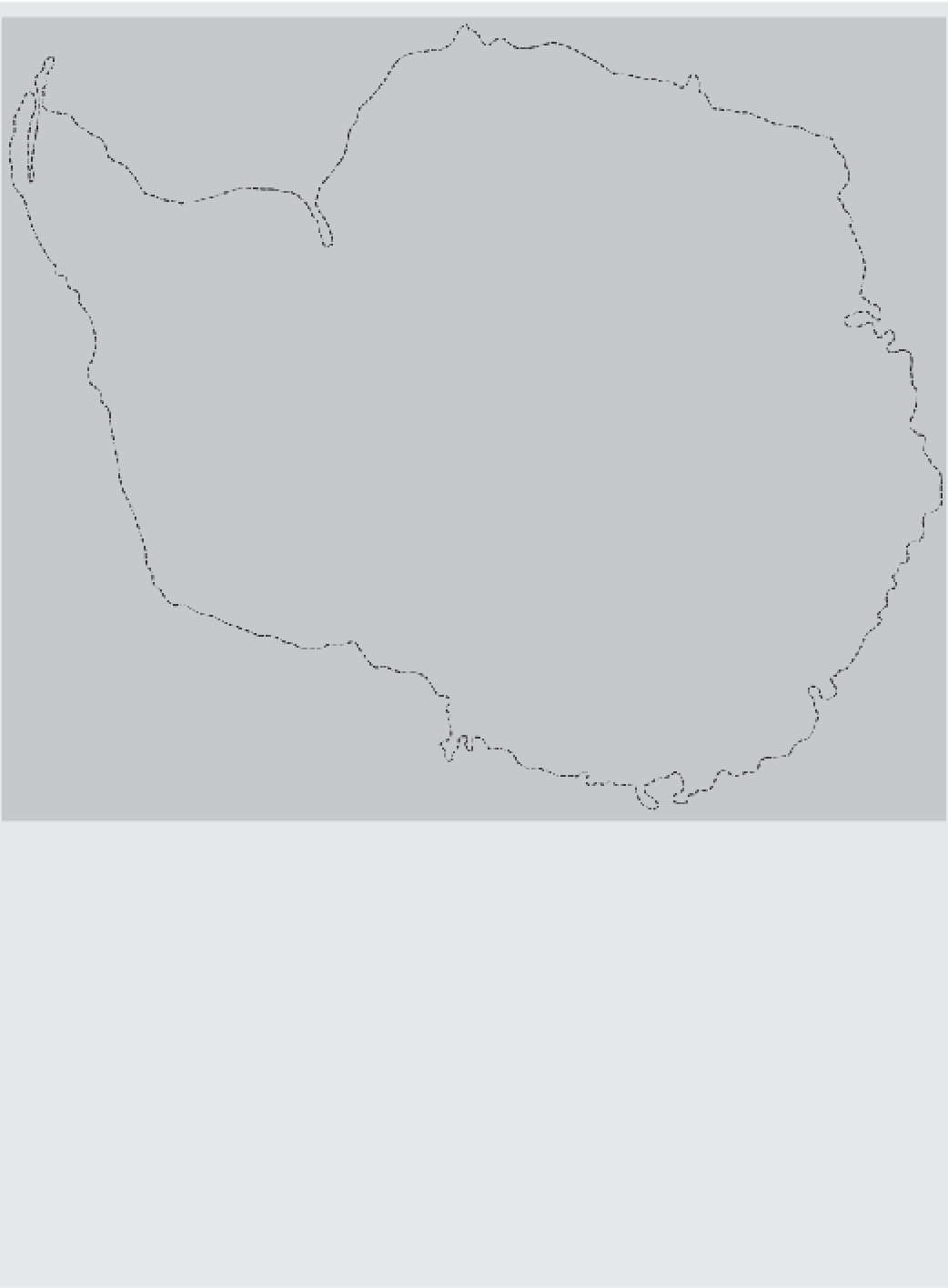
Figure 10.2
Antarctica. The dashed outer line denotes the 500-m bathymetric contour, dashed interior lines denote
ice divides with domes D and saddles S, solid lines denote tidewater ice-sheet margins, hachured lines denote ice shelf
calving margins, dotted lines denote ice shelf grounding lines, and black areas denote mountains above the ice sheet.
Source:
Adapted from Hughes
et al
. (1985)
and are frozen to the bedrock. Its ice ranges in
thickness from approximately 2,000 to 4,000 metres.
Terrestrial ice streams drain the edge of the East
Antarctica inlandsis, which contains several ice shelves,
including the Amery Ice Shelf. Only the Lambert
Glacier runs deeply into the heart of the ice sheet.
The West Antarctic inlandsis lies on a generally
rugged bedrock floor, much of which lies below
sea level. If the ice were to melt, this floor would
rise
several islands, this area would remain below sea
level. In part owing to the ruggedness of the bedrock
floor, the surface of the West Antarctic inlandsis has
an irregular topography. Floating ice shelves in pro-
tected embayments, such as the Ronne Ice Shelf,
fringe it. Marine ice controls the seaward drainage.
The West Antarctica inlandsis is the world's only
remaining marine ice sheet. It is grounded over deep
interior subglacial basins, which helps to stop its
collapsing.
through
isostatic
compensation.
Apart
from