Agriculture Reference
In-Depth Information
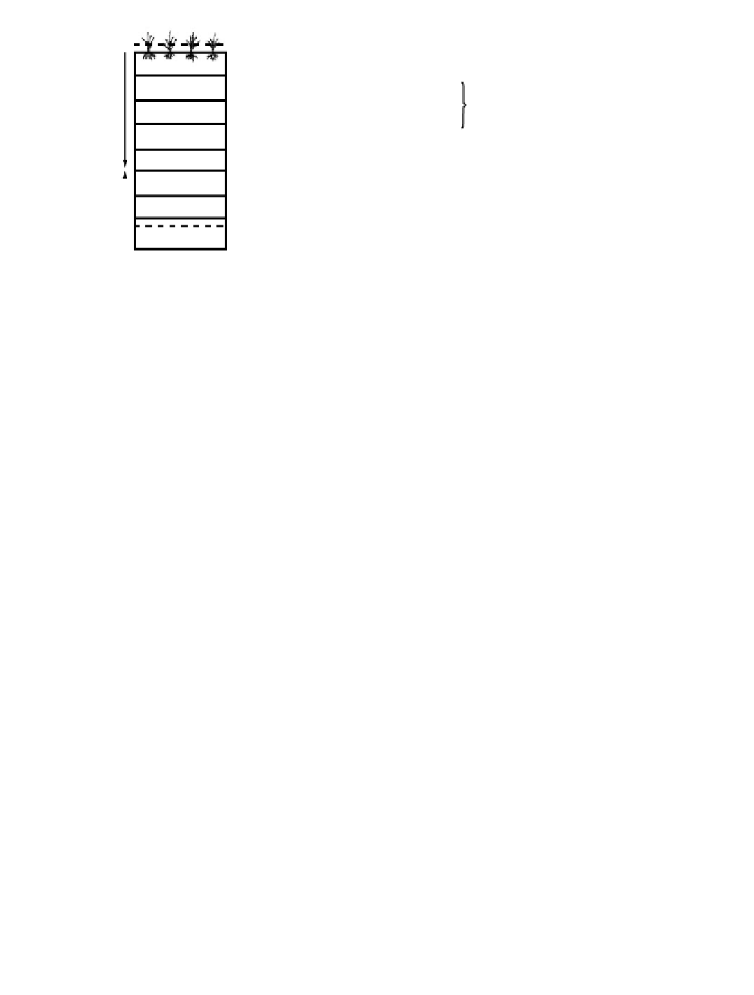
A
p1
A
p2
Cultivated horizon
}
Anthraquic epipedon
Plowpan
Anthraquic horizon sequence
B
rl(ir)
Fe-agric horizon
}
Hydragric horizon
B
r2(mn)
Mn-agric horizon
B
r3
B
r4(mn)
B
r5(ir)
Mn-accumulation horizon
Fe-accumulation horizon
G
Figure 10.9
Sketch of the profile of typical Hydragric Anthrosols. (From Gong et al., 1999. With permission.)
¤ nonobvious iron-manganese deposition, mainly in the form of mottles
¤ an iron-manganese deposition differentiation formed by surface water, with the upper part
containing mainly iron oxides concretion (mottles, concretions, and nodules), and the lower
part black manganese oxides deposition (black spots, mottles, concretions, and nodules), besides
new formation of iron oxides
¤ iron-manganese oxides, newly formed by both surface water and underground water, and from
top-to-bottom appearance of iron-manganese-manganese-iron deposition subhorizon
¤a greyish iron-depleted subhorizon adjacently underlying anthraquic epipedon, which, however,
does not meet the requirements of albic horizon, and the iron-depleted matrix with a hue of
10YRÏ7.5Y, a color value (moist) of 5Ï6, a chroma of 2 or less, and a few mottles
¤except iron-depleted subhorizon, free iron content in the other layers being at least 1.5 times more
than that of plough horizon
¤
grey humus-silt-clay cutans 0.5 mm or more in thickness on ped faces and voids
¤
an obvious prismatic and/or angular structure
Irragric Epipedon
The irragric epipedon (siltigic epipedon) is an anthropic surface horizon formed by gradual
deposition of suspended particles during long-term irrigation and the mixture of cultivation. An
irragric epipedon meets the following requirements:
¤a thickness of 50 cm or more
¤a uniform color, texture, structure, consistency, calcium carbonate content, etc
.,
in the whole
epipedon, and the textures of the adjacent subhorizons located in the adjacent positions of
triangular textural diagram stipulated by the United States Department of Agriculture (USDA)
(Figure 10.10)
¤ the weighted average of organic carbon being 4.5 g kg
-1
or more within 50 cm of the soil surface,
and gradually decreasing with increasing depth, but at least 3 g kg
-1
at the bottom of the horizon
¤ after soaking for an hour and screening through a 0.2-mm wet sieve, showing sub-rounded and
dense soil plates, within which the silted micro-beddings may be seen using hand lens; or micro-
morphologically, having the agripedoturbation features showing sub-rounded or rounded plasmic
aggregates, inside which, sometimes, residual silted laminae may be found
¤having coal cinders, charcoals, brick, or tile fragments and other artiÝcial intrusions throughout
the horizon