Environmental Engineering Reference
In-Depth Information
data, otherwise it is possible to arrive at completely
different conclusions about their reliability (Grayson
et al
., 1992a, b). Similarly, if the scale of the output is not
related to the scale of the test data, errors in interpretation
can arise. It is for this reason that techniques of upscaling
or downscaling of model results are important (see
chapter 20). For further details on the technicalities of
different types of error, refer to Engeln-M ullges and
Uhlig (1996) and Mulligan and Wainwright (2012).
REA
or
REV
2.5.2 Fromerror touncertainty
Area or volume being measured
Zimmerman (2000) defines six causes of uncertainty in
the modelling process: lack of information, abundance of
information, conflicting evidence, ambiguity, measure-
ment and belief.
A lack of information
requires us to
collect more information, but it is important to recognize
that the
quality
of the information also needs to be appro-
priate. It must be directed towards the modelling aims
and may require the modification of the ways in which
parameters are conceived of and collected.
Information
abundance
relates to the complexity of environmental
systems and our inability to perceive large amounts of
complex information. Rather than collecting new data,
this cause of uncertainty requires the simplification of
information, perhaps using statistical and data-mining
techniques.
Conflicting information
requires the applica-
tion of quality control to evaluate whether conflicts are
due to errors or are really present. Conflicts may also
point to the fact that the model being used is itself wrong,
so re-evaluation of the model structure and interaction
of components may be necessary.
Ambiguity
relates to
the reporting of information in a way that may provide
confusion. Uncertainty can be removed by questioning
the original informant, although this approach may not
be possible in all cases.
Measurement uncertainty
may be
reduced by invoking more precise techniques, although
it must be done in an appropriate way. There is often a
tendency to assume that modern gadgetry will allow mea-
surement with fewer errors. It must be noted that other
errors can be introduced (e.g. misrecording of electronic
data if a data logger gets wet during a storm event) or that
the new measurement may not be measuring exactly the
same property as before.
Beliefs
about how data are to be
interpreted can also cause uncertainty because different
outcomes can result from the same starting point. Over-
coming this uncertainty is a matter of iterative testing
of the different belief structures. Qualitative assessment
is thus as much an aspect of uncertainty assessment as
qualitative analysis.
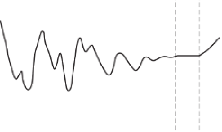
Figure 2.3
Definition of the representative elemental area
(REA) or volume (REV) concept.
extreme case, the system will be completely lumped,
with single values for parameters and each input and
output. Such models can be a useful generalization, for
example in the forecasting of flooding or reservoir filling
(e.g. Blackie and Eeles, 1985 - another example is the
population models discussed above, although these can
be spatialized as shown by Thornes, 1990). However, the
definition of each parameter may be non-trivial for all but
the simplest of catchments. Wood
et al
. (1988) used the
term representative elemental area (REA) to evaluate the
scale at which a model parameter might be appropriate
(Figure 2.3). At the opposite end of the spectrum is the
fully distributed model, in which all parameters are spa-
tialized. There still remains the issue of the REA in relation
to the grid size used (distributed applications may still
have grid sizes of kilometres - or hundreds of kilometres
in the case of General Circulation Models). However, in
addition there is the issue of how to estimate parameters
spatially. Field measurements are costly so that extensive
data collection may be impossible financially, even if
the people and equipment were available on a sufficient
scale. Therefore, it is usual to use some sort of estimation
technique to relate parameters to some easily measured
property. For example, Parsons
et al
. (1997) used surface
stone cover to estimate infiltration rates, finding that the
spatial structure provided by this approach gave a better
solution than simply assigning spatial values based on
a distribution function of measured infiltration rates,
despite the relatively high error in the calibration between
stone cover and infiltration rate. Model sensitivity to
different parameters (see above) may mean that different
techniques of spatialization are appropriate for the
parameters of the model in question. It is important that
distributed models are tested with spatially distributed


Search WWH ::

Custom Search