Environmental Engineering Reference
In-Depth Information
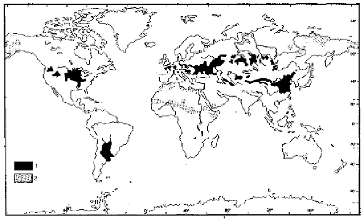
Figure 6.1 presents the geographical repartition of loess deposits all over the
world. In the figure, number 1 (black areas) represents loess deposits and number 2
(gray areas) represents “loess-like” sediments. Loess deposits are located on
plateaus, slopes and in main alluvial basins. In China, the thickness of the “plateau
loess” layer can reach 300 m locally. Loess deposits are also found on the plateau of
Siberia, in the Russian lowlands [GRI 94] and in the basins of the rivers Danube and
Rhine in Europe and Mississippi in North America. All these areas are located
between the 30
th
and 50
th
parallel in the Northern hemisphere. Note also large
deposits in the Argentinean Pampa.
Figure 6.1.
Loess deposits across the World
(from [PEC 90])
Figure 6.2 presents the mechanisms of the formation of aeolian loess deposits:
- thin particles produced by glacial abrasion are washed out, transported by
proglacial flows and redeposited close to the moraine (outwash plains);
- sand, silt and clay particles that are submitted to freeze-thaw cycles are eroded
and transported by violent and permanent cold and dry winds generated by high
pressures above ice-sheets;
- larger sand particles are first deposited as dunes and as sand cover;