Geography Reference
In-Depth Information
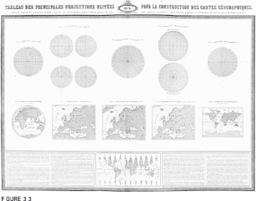
Illustration from 1862 showing 15 projections.
From
www.davidrumsey.com
. Reprinted by permission of David Rumsey.
conventions or even laws that state what projection must be used for certain
areas and activities (see Chapter 5). This is usually a good thing, but many
institutions and governments require multiple projections.
Whatever you do with geographic information or maps, you need to
know some projection concepts in order to understand projection distor-
tions and their consequences. Some geographic information is stored in lati-
tude and longitude coordinates and can be displayed or mapped on a flat
screen or piece of paper, but these “unprojected geographic coordinates,” as
they are usually called, have tremendous amounts of distortion when shown
on a flat plane.
Four fundamental concepts are crucial to know when you use geo-
graphic information and maps:
1. The earth is almost round, and always changing shape
. Three models of
the earth are used in making projections: sphere, ellipsoid, and geoid. A per-
fectly round object, or
sphere
, is defined by the mathematical relationship
between the center of the object and its surface, the radius. The surface of a
sphere is a constant distance from the object's center. This is the simplest
model used in projections and is sufficient for geographic information and

Search WWH ::

Custom Search