Geography Reference
In-Depth Information
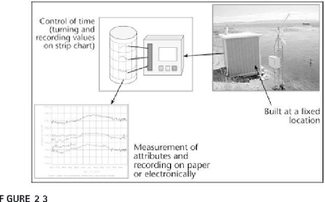
Stream gauge showing fixed location, measured attributes (strip chart), and con-
trolled time (minutes/hours).
location based on the measurement of space for a fixed attribute. Second,
this scheme gets very complex if even everyday objects with many measure-
ments are considered. Third, and most importantly, Sinton's scheme does
not take into account relationships. As in the river flooding example
before, implicit water levels can only be related by use of common eleva-
tion base values.
Raster and vector geographic representations and Sinton's framework.


Search WWH ::

Custom Search