Geography Reference
In-Depth Information
comparing the elevation of the neighboring cell with the origin and going
outward to other cells if the cell in question is at an elevation equal to or
below the elevation of the origin cell. This type of terrain analysis is impor-
tant in environmental mediation, planning, and the location of transmission
towers. It also can be used as part of more complex terrain analysis—for
example, considering the impact of large-scale landscape changes on snow-
melt processes.
More complex raster-based terrain analysis is used for countless envi-
ronmental applications. Watershed processes, erosion, and sediment yield
analyses often use terrain analysis as part of more comprehensive analysis
that takes account of dynamic processes that are ill-suited for factor analysis.
A sediment yield analysis, for example, can consider soil types, vegetation,
geology, maintenance practices, water absorption capacity, and numerous
other factors as part of a dynamic principal component analysis that
accounts for the amount of precipitation and duration as key variables. Prin-
cipal component analysis aids the simplification of complex statistical rela-
tionships through the identification of independent and uncorrelated vari-
ables.
Vector-based terrain analysis is used less frequently because the GI rep-
resentation of vectors in commercial GIS produces sharp boundaries that
generally do not reflect the field nature of environmental things and events.
It does find many applications in detailed engineering work—for example, in
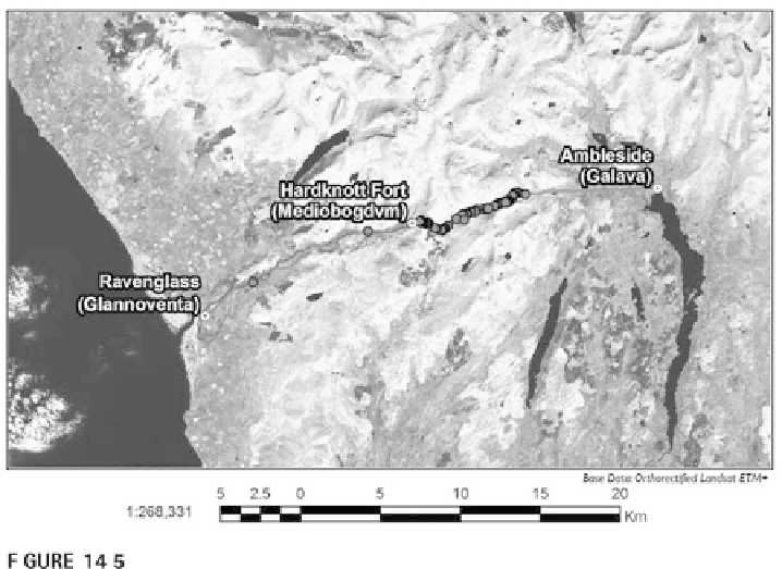
Archaeological least-cost model of the possible path of a Roman road in England.
Slope is considered to be the primary determinant of the possible path of the road.
Courtesy of Jason Menard.

Search WWH ::

Custom Search