Geography Reference
In-Depth Information
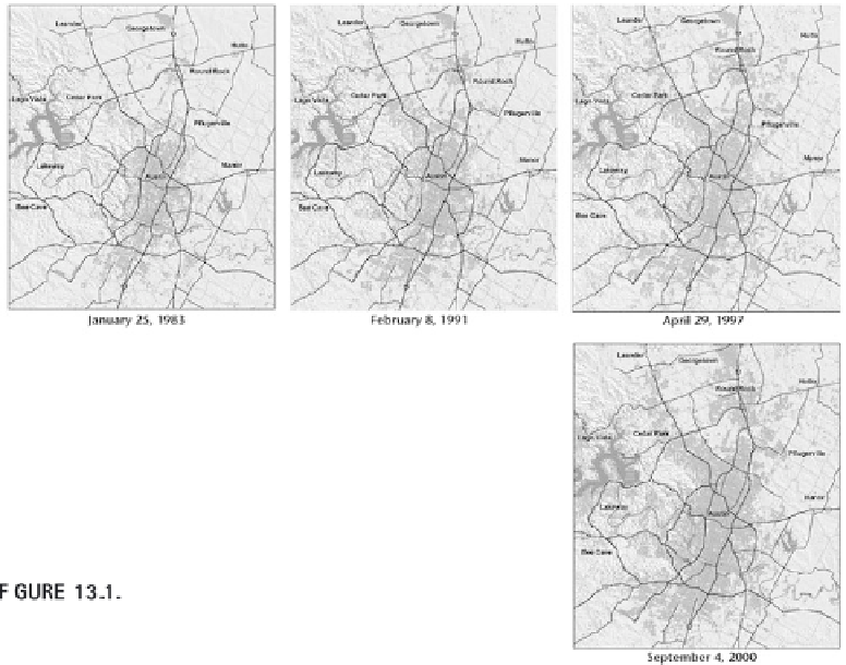
Growth of Austin, Texas, showing urbanized areas
in 1983, 1991, 1997, and 2000.
From
http://tx.usgs.gov/geography/austgrth_large.htm
SIMPLE/COMPLEX
GI analysis can range from simple to complex.
Simple
refers to activities
involving interpretation or comparisons.
Complex
refers to geostatistical anal-
ysis and process modeling. In between simple and complex types of analysis
lies a vast range of analysis types and transformations. For example, a simple
geographic information analysis may consist of merely comparing two data
sets of the same area collected at different times, combining a forest-type
data set with a soils characteristics data set, or using buffer operations to
determine the service area of a proposed bus route change. Complex analy-
ses can use Monte Carlo simulations to assess which distribution of soil pH
values most likely matches the stochastic distribution, use fuzzy-set theories
to assess the inaccuracy of boundaries around vegetation types, or rely on
variance calculations to help determine the reliability of field data samples.
Many or even most geographic information analyses lie in between
these two poles. They will rely on some transformations and an interpreta-
tion or comparison. For example, creating a buffer around a factory which is
submitting an expansion plan for the facilities is the transformation neces-
sary to combine this buffer with the positions of buildings whose owners
need to be informed about the permit application. Many transformations
can be linked to a single interpretation or comparison, or each transforma-
Search WWH ::

Custom Search