Geography Reference
In-Depth Information
the remote sensing is based on satellite images or data, in most cases we are
likely to have multispectral, hyperspectral, or radar images or data. If it is air-
plane-based, then we are more likely to have aerial photography,
multispectral, or LiDAR images or data. If it is ground-based, then we are
most likely to find photography, multispectral, or LiDAR images and data.
These rules of thumb have exceptions, of course, and will change as certain
types of sensor technology and remote sensing systems become cheaper.
They are simply helpful in seeing the relationship between costs, types of
data, and application types. Applications in smaller areas tend to use air-
plane-based or ground-based sensor technologies; larger areas tend toward
satellite-based remote sensing.
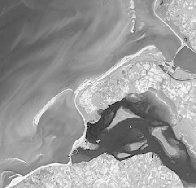
Coastal Monitoring
An important application area is coastal monitoring. Because of the key role
of dynamic processes in coastal erosion, coastal monitoring applications
tend to use remote sensing sources that can repeat their observations often.
Aerial and LiDAR photography and data may be suitable for smaller areas if
the area is generally cloud-free; multispectral satellite images and data may
be useful for larger areas, and radar may be used for large areas, or areas
with frequent cloud cover.
Global Change
With an increase in average temperatures worldwide, shrinking glaciers, and
shrinking ice packs, the study of changes to glaciers and Arctic and Antarctic
ice fields has benefited greatly from the use of remote sensing images and
data. The frequency of observations helps scientists keep track of changes to
ice fields and even icebergs in the water. Detailed observations, combined
with
measurements
on
the
ground,
help
researchers
monitor
minute
Multispectral sensors produce data and
imagery to help monitor and model complex coastal
changes.
From
http://earthasart.gsfc.nasa.gov/images/
netherla_hires.jpg


Search WWH ::

Custom Search