Geography Reference
In-Depth Information
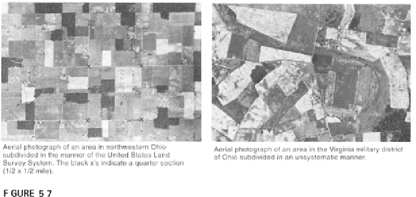
Different location systems used in surveying have environmental consequences.
From Thrower (1966). Reprinted by permission of Norman Thrower.
the capabilities of the surveying equipment or the surveyors. Errors may
have been made in spite of thorough cross-checking of survey measure-
ments. Some people hired to conduct surveys sought short-cuts to simplify
the work, and produced surveys that were complete on paper, but may have
distorted things on the ground. Regardless of the limitations, errors, or
frauds, the markers placed by the “original” surveys are considered the ulti-
mate authority for all later land subdivisions and locations, even if some
quite complex problems required later resolution.
The PLS's consequences go beyond the creation of a system for subdi-
viding land and the development of the ability to systematically locate land in
most of the United States. The “original” survey marked the land for future
development. If you have ever flown across the midwestern or western
United States and looked out the window, you probably noticed a landscape
that looks like a grid stretching out to the horizon. Traveling in a car on
many roads in this area, you probably noticed that the road goes straight for
a long time, with only minor deviations, and intersections with roads are
mostly at right angles. Both are the consequences of the PLS. But there are
more significant consequences, which are environmentally and economically
significant, as Norman Thrower discussed. First, the PLS subdivision of land
does not follow existing natural features, which usually help guide the use of
land. Intensive farming practices in PLS areas can more easily have detri-
mental effects than the same practices in areas surveyed using metes-and-
bounds surveys. The roads in the PLS may be easier to drive on, but the costs
of maintaining bridges may be higher because they have to be longer. In
Thrower's study, he established that 60% of all bridges in an area surveyed
using PLS were longer than 20 ft (6 m), versus only 20% in areas that were
surveyed unsystematically.

Search WWH ::

Custom Search