Geology Reference
In-Depth Information
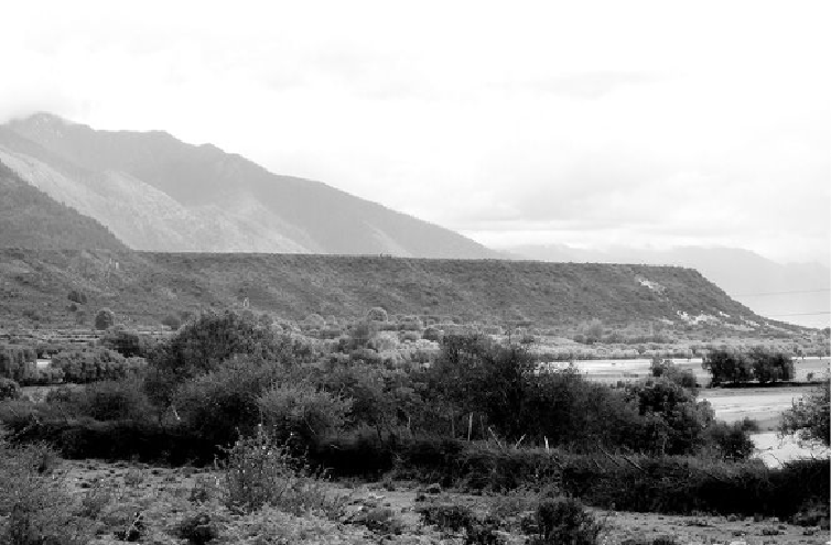
Photograph of a topographic terrace, the top of which corresponds to the level of an ancient lake that once filled the
valley of the Tsangpo River, Tibet
(
photograph by the author
).
Over the course of our several-week expedition I collected the pieces of a landscape-
scale puzzle. Flat-topped piles of loose sediment—gravel, sand, and silt—stuck up hun-
dreds of feet into the air where tributary valleys entered the main valley. More terraces lay
at about the same elevation at each confluence where smaller streams joined the river. From
our hotel near the foot of the valley wall we could see a terrace rising above the edge of
town a few blocks away. A short hike up a dirt road cut up through the side of the terrace
revealed hundreds of alternating layers of silt and finer clay. Segregation into distinct layers
sorted by size meant that these sediments were laid down in quiet water. Such fine material
would not have settled out in a turbulent river. The implication was clear. An ancient lake
once filled the valley.
Sketching the extent of the flat terrace surfaces onto our map as we drove along the val-
ley, I badgered my compatriots into occasionally stopping for a closer look at these curious
piles of sediment laid out like a giant's playground. Some were dried-up gravel riverbeds