Information Technology Reference
In-Depth Information
As stated in the study of Rousseaux and Lhoste [
26
], satellite views in high
resolution are provided for certain zones as well. Apart from this, the street view that
covers 360
o
panoramic street level views of plenty of cities is offered as well. In this
chapter, Google Maps API is used to show the tracking results on the web page.
2.3.2 Hand-Classified Dataset
We use a hand-annotated dataset for training and testing the Twitter sentiment analy-
sis algorithms purposes, it is composed of 1,035 hand-classified tweets as positive
and negative.
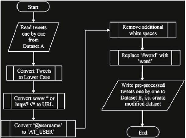
In order to preprocess the raw tweets, Python script was written. This script
mainly reads all tweets from our dataset and preprocesses all of them as can be seen
in Fig.
2.2
. Then, it writes these preprocessed tweets into a new dataset.
2.3.3 Background Processes
2.3.3.1 Tweet Collecting
A Python script written for this chapter collects all tweets about the four brands based
on 17 cities where the tweets are sent. Figure
2.3
shows the flowchart of this script.
Fig. 2.2
Flowchart of preprocess steps for dataset
Search WWH ::

Custom Search