Environmental Engineering Reference
In-Depth Information
exploitation of mangroves for fodder and fuel-
wood by local communities including the
Maldharis is a complex problem with several
inter-related causes. Due to increasing govern-
ment control of natural resources, the people
living around mangroves have lost control over
the management of common property resources
in their areas. Earlier, their traditions and cus-
toms ensured the proper stewardship of natural
resources but now, these age-old safeguards have
unfortunately broken down. The result has been
unproductive village commons, and when
accompanied by frequent droughts, the pressures
on mangroves for fodder and fuel-wood have
only been accentuated.
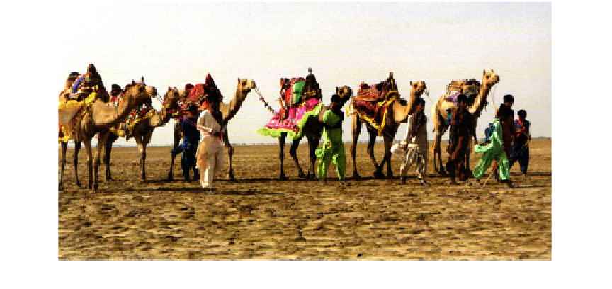
Compared to other common lands, mangrove
regions have an advantage, in that cattle are
unable to brave the damp, muddy conditions for
free-grazing. This advantage is, however, lost in
case of camels, as they can freely move about and
can even cross the creeks when there are low tides.
A mere one instance of free roaming by herds of
camel can often devastate large mangrove areas,
as their feet trample the pneumatophores of
mangroves, blocking respiration (Fig.
7.36
).
For feeding cattle, the people visit the man-
grove forests to collect the protein-rich mangrove
leaves. These leaves are usually preferred over
other grasses as fodder due to their high nutritive
value. The village folk cut leaves and pack them
in large bundles that they haul on their heads
(Fig.
7.37
).
The grazing pressure on mangroves and salt
marsh grass is also witnessed in some islands of
lower Gangetic delta. The name of Nayachar
Island (Fig.
7.38
) is very relevant in this context.
The island is located about 56 nautical miles
south of Kolkata, directly facing the port-cum-
industrial complex of Haldia. The island is
bounded by latitudes 21
°
′
″
°
′
″
54
41
N
-
22
01
28
N
and longitudes 88
E. The
island has an area of about 47 km
2
and a maxi-
mum elevation of 6.5 m above mean sea level
(MSL). Length of the island centrally measured
from North to South is 15,861 m and from East
to West is 4,340 m.
The land topography is generally
°
03
′
02
″
E
88
°
08
′
43
″
-
at, with
elevation ranging from a low of 1.08 m MSL to
as high as 3.68 m MSL along the coastal region
of the island. Average ground level of the island
is 1.366 m MSL. The island is convex upwards
with gently sloping eastern and western
fl
anks.
The eastern flank is undergoing erosion at pres-
ent while the western edge is accreting.
According to recent estimation, the present
accretion rate is about 1 km
2
/year on the Haldia
port area and the erosion rate is about 0.05 km
2
/
year on the eastern part of Nayachar. The island
is exposed to strong scouring action of the run-
ning Hugli River and hence a programme was
fl
Fig. 7.36
Camels in the Gujarat coast going for mangrove grazing